
To borrow a phrase from Forrest Gump:
Tunneling is like a box of chocolates, you never know what you're going to find.
People have been constructing tunnels for thousands of years and, it's always been a royal pain in the keister. Often, the motivation was access to minerals like salt, coal and metal ores. The ancient Greeks and later, the Romans, painstakingly hollowed out mountains to create gently sloping water galleries that supported their cities. These days, the best-known tunnels are for transportation arteries, i.e. roads and rail. Think of the Seikan linking the islands of Honshu and Hokkaido in Japan, the Channel Tunnel between France and the UK and, the Saint Gotthard and Lötschberg base tunnels through the Alps in Switzerland to name just a few. There are even plans for a rail tunnel under the Straits of Gibraltar that would link Spain and Morocco. Like the Tsugaro Strait, this area is seismically active. Also, the combined weight of the overburden and the water above it would squeeze out water trapped in the rocks surrounding the tunnel. Pumps would have to operate continually just to keep it from flooding, at least during the construction period.
By comparison, each of the tunnels in the California HSR network will be a run-of-the-mill project - but only when viewed in isolation. All told, the construction of the starter line will involve dozens of track-miles of tunnel construction.
Mountain Crossings
Individual tunnel systems longer than 6 miles must feature additional emergency escape routes, but that will not be necessary in the context of the HSR project. All the major slip-strike faults along the route can be crossed at grade, which greatly simplifies not just rescue efforts but also repairs to the tracks. However, a secondary fault near Pacheco Pass will have to be crossed underground.
During a 2001 tunneling workshop (report, slides), CHSRA used Australian software called Quantm to identify optimized alignment options for each possible route choice through e.g. the transverse range, based on the best available geological information at the time. The software automatically generated and analyzed thousands of variations to cull those that did not meet constraints such as bore length, maximum gradients and the desire to cross major faults at grade.
The results overturned those of a less sophisticated 1994 study by Parsons Brinkerhoff, shaving billions off the estimated cost and sharply reducing the risk of drilling into pockets of natural gas or aquifers. For reference, 32 workers died in an explosion during the construction of railroad tunnels through the Santa Cruz mountains in the 19th century. More recently, errors in tunnel design and construction in Andalucia (Spain) led to a major environmental disaster for a once-thriving small town of Valle del Abdalajis:
View this video on YouTube
For reference, similar water columns exist in Pacheco Pass, draining them would turn prime farmland in part of the west side of the Central Valley near Los Banos into a virtual desert.
Among other findings, the Quantm study showed that an alignment along the Grapevine is affordable, though far fewer feasible variations were found there than through the Tehachapis. The only one that crosses both the Garlock and the San Andreas at grade would run close to the wildlife refuge at Lake Castaic. Considering that there is always uncertainty regarding the detailed geology inside mountain ranges, engineers recommended the latter option, even though it adds 60 miles and 12 minutes to the SF-LA line haul time. For a map of where the tunnels through the transverse range will be, plus cross-sections of the alignment at selected points, see part 1, part 2 of the Bakersfield to LA portion of the program EIR/EIS.
The decision in favor of the Tehachapis dovetailed nicely with LAWA's plans to leverage Palmdale as a relief airport for LAX, but it also risks promoting further population growth - transit-oriented or otherwise - in the arid High Desert. Moreover, it was one of the factors that prompted CHSRA to select the fastest possible route out of the Bay Area. According to CHSRA's analysis, San Jose to Fresno via Pacheco is 10 minutes faster than via Tracy. Are the time savings worth sacrificing an SF-Silicon Valley-Sacramento run-through route via SantaClara/SJC that would be time-competitive with driving on I-80 and other congested Northern California freeways/bridges? Controversially, CHSRA concluded that they are.
In a recent and bitter twist to this saga, the foreclosure fiasco recently prompted United Airlines to cancel its last remaining flights between Palmdale and SFO due to lack of demand. Without any prospects for attracting other commercial carriers anytime soon, LAWA is now mulling "temporarily" converting the airport into a giant solar farm. That would have to be relocated - at considerable expense - in the future before the airport could be re-opened, because the glare of the solar farm would blind pilots. Renewable electricity is wonderful, but without planning certainty regarding Palmdale airport, an HSR detour via the High Desert makes no sense at all.
Tunneling Techniques
Civil/mining engineers have multiple technologies at their disposal, the optimal choice depends on the geology involved. Very long tunnels involve massive logistical efforts to get personnel and materials to and from the face of the tunnel during construction, so small exploratory tunnels and/or shafts are excavated to improve knowledge of the local geology at the meter scale. For the Channel Tunnel, whose alignment follows a seam of chalk marl, construction of the third (service) tube was used for the purpose. Base tunnels in the Alps rely on vertical shafts as emergency escape routes of last resort, supplementing the horizontal route along the length of the adjacent track. For high speed trains, engineers prefer separate tubes in each direction, linked every so often by cross tunnels. Trains act more or less like pistons, pushing a column of air out ahead of them. In addition to serving as evacuation routes, the cross tunnels provide a way for the air to escape, reducing drag losses. The cross tunnels feature firewalls that are closed in the event of a fire in one tube so the other is preserved for limited service during repair works. This off-design scenario applied to the Channel Tunnel just recently.
View this video on YouTube
Extremely hard rock must be carefully blasted with dynamite, which is why the Swiss base tunnels feature a single tube for two adjacent tracks. This is suboptimal for high speed operations because the aerodynamic interactions of the train with its surroundings are asymmetrical, which can cause sway (lateral motion) and even dynamic instability. However, since those tunnels will carry mostly freight and auto trains, the lower cost of blasting just one tube won out. These days, engineers try to apply the New Austrian Tunneling Method, which relies on precise measurements of the way the overburden (rock above the tunnel) settles as the load redistributes to either side of the tunnel. The application of shotcrete (sprayed concrete grout) and especially, the installation of support rings assembled from prefabricated segments are avoided as much as possible to keep costs down.
For rocks of intermediate hardness, the cheapest and hence preferred option these days is to use a pair of giant Tunnel Boring Machines (TBMs). These leviathans feature a huge rotating cutting face supported by a support infrastructure for slurry (water + bentonite, a mineral lubricant), rock crushing and shotcrete/ring construction to stabilize the section just excavated. The ring segments are shaped such that the two faces of the completed ring end up at a slight angle to one another. This permits the implementation of tunnels with gentle lateral and/or vertical curves. Laser-based geodetic systems are used to precisely guide the direction the TBMs take, such that two such machines drilling toward one another meet up within inches of each other after miles of tunnel construction. In the Channel Tunnel project, the business ends of the TBMs were steered past each other and parked in dead ends for the rest of eternity, because it would have been more expensive to dismantle and remove them.
TBMs are also used for tunnel construction in urban areas, e.g. the Canada Line light rail project in Vancouver, BC. To get a better idea of just how complex and risky tunnel construction in built-up areas can be, I highly recommend you take 50 minutes to watch the following excellent documentary on the Kuala Lumpur Mega Tunnel (the other SMART) project in Malaysia (while it's still available). The single giant bore and dual use objective differentiates it from what would be needed for boring deep tunnels for four tracks underneath Palo Alto, an idea that CHSRA has been asked to study. In addition to the massive disruption to vehicular traffic and residents near the point(s) of surface access, the single biggest headache would be the risk of subsidence under the active rails, an existing under- or overpass, the frontage roads and high-value buildings such as hospitals and high schools. The end result may be worth having, but construction could be a nightmare.
As for the price tag of $250 million, Malaysia isn't Silicon Valley. Not even close. If the project to extend BART to Santa Clara via bored tunnels through San Jose is any indication, figure upwards of $500 million per mile in the Bay Area.
View this video on YouTube
View this video on YouTube
View this video on YouTube
View this video on YouTube
View this video on YouTube
For soft rock, such as is found in downtown San Francisco, the preferred option is to cut deep trenches from the surface and cover them later on to restore the road surface. This is noisy, messy and highly disruptive to traffic during the construction period, but you can't make an omelet without breaking any eggs. Unfortunately, trains - high speed trains in particular - cannot negotiate tight corners, so buildings above them either have to be demolished first or, old-fashioned shield construction techniques applied. These are very labor-intensive and therefore expensive. Flooding, subsidence and earthquake risks all complicate their application, so they are used as sparingly as possible.
On the plus side, the incremental environmental impact required to construct two levels of tracks stacked on top of one another isn't all that great. This may be why some are advocating the construction of a second deck of platforms under the new Transbay Terminal Center. Personally, I very much doubt claims that the capacity afforded by the present single-deck design with 6 full-length platform tracks will ever present a bottleneck for HSR or even Caltrain. Also, access to platforms on a second, deeper deck would introduce serious pedestrian flow capacity and emergency evacuation issues, in addition to substantially higher cost. While there will be no tanks full of diesel or other flammable materials to worry about, extremely rare electrical fires are possible - as are earthquakes or terrorist attacks.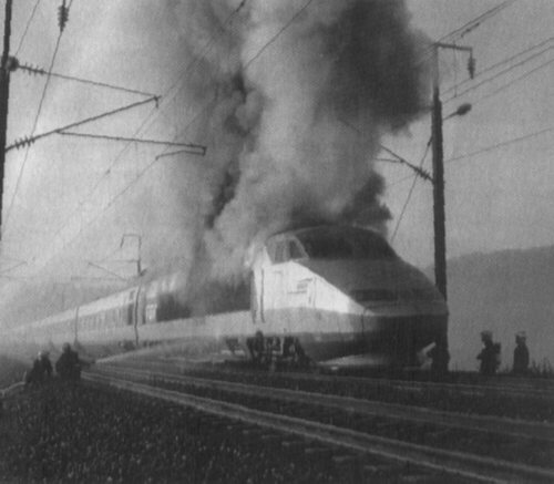
Conclusion
There are ways to put trains underground, but digging always involves a lot of risk and money. All possible above-ground approaches should be evaluated and rejected before opening Pandora's Box.
Friday, March 13, 2009
Pandora's Box
NOTE: We've moved! Visit us at the California High Speed Rail Blog.
Subscribe to:
Post Comments (Atom)

48 comments:
Should note that I'm planning a bigger post on the Transbay Terminal for tomorrow, but have a busy workday today that means such a post will have to come tomorrow.
A valid case can be made for tunneling for the 1/4 mile stretch leading up to and out of Diridon Station in San Jose, I believe. The caltrain tracks in the immediately adjacent area are the most curved in the region, and (again) these go right through a residential area that is likely to sue/protest etc. The good news is that this piece is relatively small, starting at 87 freeway in San Jose, underground through the Willow Glenn area there which flattens out the S-shape, and into Diridon. At least that section of this train could probably get built with tunneling in that one small portion, although it would probably cost a few hundred million even though the route is short- it is complicated.
@Rafael
Absolutely amazing post --- thank you. I must say I don't understand how you you estimate a possible only $500 million / mile when BART talks about $600 million / mile for 2 tracks and CHSRA now estimating $2.4 billion for the 1.4 miles from King Street to the TBT (2 tracks I think). From those cost estimates I would think $1 billion / mile (and upwards) is much more realistic.
Again great thanks for this marvelous post.
@ BAR -
I'm no expert on Caltrain yard operations, but it seems to me simply swapping out three straight yard tracks for the three curved through tracks would eliminate that chicane. At first glance, I see no good reason for constructing an HSR tunnel in the area.
At second glance, perhaps it's planned because BART is supposed to run at grade underneath I-880. Keep that underground, shift the UPRR and Caltrain tracks east a bit and the need to spend oodles of dollars on the planned tunnel between San Tomas Expy and SJ Diridon - far more than 1/4 mile - disappears completely. There are other places in the peninsula that need that investment more than the front yard of the Mineta Institute.
An HSR tunnel under the Caltrain/UPRR tracks in Santa Clara/SJC would only be needed if no ROW down to Gilroy could be secured, forcing a route change to Altamont - minus any new bay crossing. That's because the preferred way out of the south bay would then be I-880 median/CA-262 median/tunnel/Calaveras Rd/tunnel/El Charro Rd (intermodal BART to Livermore)/I-580 median/I-205 median (north Tracy station)/CA-120 median/Escalon/Modesto E. Briggsmore (intermodal Amtrak)/Castle Airport/Fresno. The biggest headache would be crossing the active Hayward and Calaveras faults at grade if at all possible.
In that scenario, Santa Clara/SJC could support run-through tracks whereas Diridon would force operators to waste precious time turning trains around. No animosity involved, SJ Diridon would then simply be in the wrong place.
Once BART is up and running, folks in downtown San Jose wouldn't care if they had to stay on the subway for one additional stop. Plus, running shuttle buses to the SJC terminals would be a snap. Only VTA light rail would lose out, unless the mid-peninsula station is sited in Mountain View (the city just asked CHSRA to studied that option). Caltrain and HSR will have to go underground there anyhow because there's no room for six tracks side-by-side, Castro needs to be grade separated and the N Shoreline/bike/CA-85 overpasses are nearby. Once tracks are underground anyhow, it's much easier to accommodate two full-length extra-wide wide island platforms (rip open part of Central Expy for a while and cover it back up later). Platforms would be accessed from pedestrian passages two levels down, with surface access on the east side of Central Expy as well.
Regardless of the route out of the Bay Area, the BART maintenance facility should be underground (all excavation from the surface) so there's room for a standard gauge yard at grade as well. The area of the Newell yard is huge and, air rights for transit-oriented office development could be sold to pay for keeping BART under the ground. There are TOD plans for the vicinity of Caltrain stations in both Santa Clara/SJC and SJ Diridon anyhow, there's no good reason not to implement both.
Btw, even though CEMOF looks on the map like it's the worst set of kinks on the Caltrain alignment, others (e.g. San Bruno and Palo Alto chicane) are arguably higher up on the list of the Top 10 Worst Curves because the differential between feasible and desired speed is much higher. All trains are supposed to stop at the South Bay station anyhow, to the time penalty imposed by CEMOF is not all that high.
Correcting legacy kinks in Caltrain ROW further north would be much more expensive and contentious, so I suspect that CHSRA will tread lightly and try to make up for lost time elsewhere along the route to LA.
In Palo Alto, it might be useful to shift all four tracks a little bit west at San Francisquito creek (away from El Palo Alto) and also at the hotel south of University to increase the curve radii of the chicane imposed by the Alma/University grade separation. That's one CHSRA should not tangle with. Palo Alto Ave will need a deep underpass, the crossing location could be moved south a little bit to increase the distance to El Palo Alto and its delicate root system.
@BAR, the curves in San Jose are just as bad north of the station as south of the station. A tunnel would add no transportation value, and the 100-foot right of way in that neighborhood (Willow Glen) is sufficient for four tracks at grade.
@Morris Brown, the TTC tunnel in SF is 3 tracks wide in the current plan.
@Rafael, BAR isn't talking about the CEMOF area. Look at the twistiness just south of Diridon, which explains why the CEMOF almost didn't make my top-10 list. Fixing the CEMOF won't fix the tangle of curves north and south of Diridon, which will impose a 60 mph speed restriction no matter how many billions we throw at it. *cough* Altamont *cough*
@ Morris Brown -
the BART bores are a little more expensive per mile because of contingencies related to a hundred-year old bridge that San Jose doesn't want to tear down. It's wooden supports are soaked in creosote but the tunnels would run within inches of them to either side. There were also cost escalations due to wrangling between neighborhoods over where the tunnels should run.
But yes, BART will be just two tracks. Digging tunnels for four tracks under Palo Alto would mean larger or more bores, so they could end up even more expensive than BART per mile. Sotto voce, I was assuming someone other than VTA's preferred tunnel builders would be selected in any tender process.
Trenching is also more expensive that staying above ground but the costs are usually much more reasonable and easier to contain. After all, retained fill embankments involve moving a lot of earth as well.
Just keep in mind that at 125mph, the vertical curve radius for the tracks needs to be on the order of 10-20km (!) to avoid giving passengers the old heave-ho. The maximum gradient at the inflection point should be no more than 1-1.5% for heavy freight trains. Combined, that means you need about 900m (~3000ft) of run length to change the elevation of the tracks by 10m (33ft).
The required vertical clearance for AAR plate H freight cars with 25kV AC OCS is 26'2", the difference would be available for the support structures of at-grade road crossings. Optionally, freight trains could use electric or two-mode locomotives so trenches could be covered with concrete slabs and about 3 ft of earth - enough for a linear park featuring small tress, water features etc.
Unfortunately, CHSRA doesn't have nearly enough money to make something that nice happen all by itself. But perhaps the right approach is to look for a solution that the locals actually want as opposed to one they can grudgingly live with and figure out how to pay for it later. All I'm trying to say with this post is that bored tunnels are no panacea.
Thanks Rafael, interesting. Current plans are for the bart subway down from Santa Clara street, the downtown area, through Diridon and north to santa clara at which point it continues above ground at some point. Meanwhile here comes HSR from the south above ground and into Diridon, didn't make any sense. The current Caltrain ROW crosses 280 somehow into Diridon- seemed like an easy case for tunneling through that small stretch to avoid something of a roller coaster effect. You bring up a good point that the train is slowing down anyway to get to the station though.
@ clem
so if there are curves north and south of Diridon, which will impose a 60 mph speed restriction. Am I not correct that all trains would stop at san jose diridon? if that's correct then the 60 mph speed restriction wouldn't matter because the train have to slow down to stop at the station anyway.
@bossyman, you are correct that all trains would stop at San Jose. That is quite distinct from the question of whether all trains should stop at San Jose.
Is the poor alignment an excuse to stop at San Jose, or is the stop at San Jose an excuse for the poor alignment?
@ Morris Brown -
forgot about the SF tunnel. That's so horribly expensive because of the shield construction technique. The soil is too soft for a TBM and those critters anyhow can't make the tight turns required.
@ Clem -
just playing devil's advocate here: can you imagine a scenario in which the Caltrain and HSR systems are operated in such a way that just two tracks would be enough for the DTX tunnel? Would that make construction significantly cheaper?
I'm thinking of a lower tph capacity limit for HSR (say, 9 rather than 12) and 11 for Caltrain, total 20 = 3 minute headway inside the tunnel. That's actually conservative considering the tight curves will anyhow impose a low speed limit. At 25mph, spatial train separation would be a full mile, ample for any emergency stops that might be needed.
However, making do with just two tracks might involve gradually deploying longer commuter (300m bi-level?) and HSR (400m bi-level?) trains and perhaps, a 3-3 split for the available platform tracks, at least during rush hour. By the time HSR ridership reaches those levels, it will no longer be necessary for every train to stop in both SF and the south bay anyhow - the hard part is getting that ridership in the first place. Each HSR train can support over 1000 passengers if needed, so 9tph is actually massive capacity for a city the size of SF, even if you generously include most of Alameda and Contra Costa counties in the HSR station's catchment area.
Someone suggested keeping it simple and running HSR/Caltrain tracks straight underneath 7th to meet up with Market/Civic Center BART. If the mountain can't come to Muhammad etc. The SFTT is a great idea, but it's arguably in the wrong place for what SF is trying to accomplish. Perhaps the buses should come to the train station, rather than cajole the trains (not even including BART) to bus terminal. The current plan is arguably a very expensive way to make the tail wag the dog. Note that I-80s western approach to the Bay Bridge is undergoing a seismic retrofit right now, the on-/off-ramps at 7th and 8th will be remodeled in that context. It would be a huge change this late in the game, but regional buses could serve an underground train station at Market-Howard/7-8th just as easily as the SFTT location.
Over time, real estate development tends to shift to where the people can get to easily rather than vice versa, cp. (albeit on a much smaller scale) how the definition of "downtown" Mountain View changed from El Camino/Grant to Castro/Villa. The financial district is already very congested as it is, so there may be value in making the Tenderloin district (aka skid row) an attractive investment opportunity for transit-oriented development.
The land occupied by the TBTT would still be prime real estate, especially with streetcar service along Mission and out to all the ferry terminals. The ugly bus ramps could go. 4th & King could remain as a backup (esp. for any remaining or new diesel-based passenger services) or be sold off in favor of a new joint yard/high speed cargo transshipment facility in Brisbane.
In the latter case, Caltrain could move its 22nd St station north to 16th St, so SF Muni could set up a new streetcar line branching off the alignment for the existing one down 3rd St that already serves the ball park. That new streetcar line could connect to BART at Mission.
@Rafael - 1 to 1.5% is the optimal maximum grade for freight trains, but it's not an absolute. The current line over the Tehachapi mts has an average grade of 2.2%, with short segments that are even steeper. Electric commuter and HSR trains can of course handle steep grades, since they have a high power-to-weight ratio and electric motors are designed to be overdriven for short periods in normal operation without damage.
Honestly, how likely is the line to be built with plate H clearance? I know the port of SF has asked for it based on the fanciful idea that they'll be transporting auto racks or something, but is anyone taking this seriously? Do they have any actual clout in the matter? (That's not a rhetorical question, I genuinely don't know and I'm curious).
Also, I'm having a hard time seeing the value of undergrounding a whole BART maintenance facility, as you propose, surely if that's a requirement for the area it could just be located somewhere else along the line where there is space available aboveground?
@Rafael
I understand the trench and fill option along the CalTrain corridor would mean shutting down CalTrain for years. I've also heard that there can be methods to continue operation while this is being done.
Other than using shoo fly run arounds, are there methods to trench and fill,while keeping CalTrain running and still avoid shoo fly tracks?
New Italian HSR line, planned to go underground Florence for 4.5 miles estimated to cost 2-2.5 billion euros (or $600 Million/mile). The underground station (50mt underground with cathedral ceiling getting emerging above ground, will cost maybe 300 Million Euros ($400 million). The line Florence/Bologna 95% under mountains (50 miles of tunneling) is costing so far 97 Million Euros/Km (over $200 Million/mile). Stay above ground my friends, stay above ground if you can. PS for Rafael: regarding your Altamont route. I live near 262 in Fremont. It's a city street, no median now (don't rely on google, they just finished work now), and it dips under the railroad, and east of I-680 right there some of the richest NIMBYs in Bay Area. Stick to Pacheco. Some grandiose plans for Florence are below (link), and causing a big stir in Italy because of mounting costs of underground option. Stick with current station at King/4th in SF instead of transbay, and will avoid HSR money evaporation. http://www.archiportale.com/progetto/firenze/norman-foster/nuova-stazione-dell-alta-velocita-firenze_274.html
http://www.rfi.it/cms-file/allegati/rfi/The%20new%20high%20speed%20BOLOGNA%20-%20FLORENCE%20line.pdf
@ Eric -
VTA owns the Newhall yard already, it is the very reason BART is being extended beyond SJ Diridon to the west side of SJC (as opposed to the terminals, because that would be altogether too useful).
Putting the BART yard underground would only be needed if a separate standard gauge yard needs to be built above it. That might be needed to avoid overloading the peninsula and SFTT with HSR traffic during peak periods (rush hour, Thanksgiving). But yes, CHSRA could also acquire the old yard up in Brisbane for that purpose. Of course, with the airport limiting how high developers can go in the Santa Clara TOD, there might be value in putting the BART yard underground for the air rights alone.
The BART line should stay underground at I-880 if that permits HSR to stay at grade, because San Tomas Expy to SJ Diridon is a long stretch. CEMOF would have to be modified a little as well (swapping track functionality) but I reckon the total cost would still be worth it.
All of that changes if CHSRA can't get a ROW down to Gilroy, because then the only way out of Dodge without a new bay crossing is via the I-880 median. That means SantaClara/SJC would permit run-through tracks and SJ Diridon would not, so the south bay HSR station would need to be changed. Not a huge issue IMHO now that BART is going ahead, from downtown San Jose it's just one extra subway stop. However, in this scenario, HSR would need to dive under the UPRR tracks, so standard gauge would be below ground and all things BART at grade.
Ergo: before CHSRA goes much further in Northern California, it needs to actually secure a viable ROW from the south bay to Fresno, not just draw one on a map and discuss how nice-to-have it would be in voluminous EIR/EIS tomes.
The plate H stuff and STRACNET designation also need to be clarified. I don't think either is a huge issue, but they are loose ends that complicate the design and construction of an HSR alignment between SF and SJ. It's really a shame the western trestle of the old Dumbarton rail bridge (was) burned down in 1998, because with some rehabilitation work, that could have been used to divert UPRR and Caltrain traffic during critical periods in the construction process.
@ Morris Brown -
shoofly tracks should be avoidable. Construct two new tracks while keeping the old ones operational, switch traffic to the new tracks and build the new alignment for the old tracks. Trains would have to slow down quite a bit for construction worker safety and, additional support structures would have to be put in place during construction, but it could be done.
For Caltrain, the alternative would be to close the ROW section-by-section and offer shuttle buses. A pain for transit users, but probably much cheaper.
The real sticking point is UPRR. It only runs one Mission Bay Hauler each way in the peninsula on any given weekday, but that's enough to throw a huge spanner in the works. It would definitely be worth investigating if repairing the old Dumbarton rail bridge first would make construction of whatever solution is decided on south of Redwood City safer, faster and cheaper. Caltrain could run limited service from SF-RC-SantaClara/SJC-SJ Diridon-Gilroy via trackage rights on the Alviso line from UPRR, limiting the impact to customers hailing from or heading to places between RC and SantaClara/SJC.
The downside is that the old bridge is 100 years old as it is. Repairing it would be like putting a brand-new engine and transmission into a 15-year-old beat up pick-up truck. On the other hand, building a brand-new HSR-capable transbay link at Dumbarton would be a whole other ball of wax.
Good call on Transbay Terminal being the tail that wags the dog.
Moving the station to 7th & Market is frankly a fascinating idea. That would make the trip substantially faster by removing three extremely tight curves, and presumably save a lot of money. The direct connection to Bart serves everyone better, too.
What do you lose? Well, the terminus is further from the financial district, but that's just a short BART or MUNI ride away. Perhaps the biggest loss is the potential to extend the high speed line in a new transbay tube. This is a possibility that may never see the light of day anyway, and certainly not until 50 years from now.
What are the options as far as real estate is concerned for a HSR station at 7th & Market?
@ Devil's advocate -
any HSR route using CA-262 would only be considered iff no ROW down to Gilroy can be secured. It's a plan B, no more.
I'm quite aware 262 is a city street, the tracks would have to be put underground there and also underneath I-680, continuing on to Calaveras Rd in a dead straight tunnel. Any NIMBYs in the East Bay would be no worse than the ones we're already dealing with in Atherton, Menlo Park and Palo Alto.
The real issue with plan B is crossing the Hayward, perhaps even the Calaveras, fault underground. Both are of the strike-slip variety, so tracks running across them would be completely bent out of shape if a big one hits. There would be unobtrusive emergency access shafts on the far side of each fault, but repairing the damage to the tracks would be much harder than if they were at grade. Typically, fairly long and wide chambers are excavated in such cases in anticipation of such an event, but of course that adds a lot of cost and is only feasible deep underground in a built-up area.
This seismic issue is why most of the original Altamont alignments involving San Jose relied on the WPML ROW just east of the UPRR tracks to run up to Niles before cutting over to Pleasanton in a curved tunnel. That fallback option has evaporated because Santa Clara county voters passed prop B in Nov to ensure the BART extension could be built. That is one of the principal reasons CHSRA selected Pacheco as plan A. Ok, now they need to actually acquire the ROW to make that possible and, UPRR isn't interested.
Side note: running tracks for a transit system parallel to an active fault is also risky. A big one would lay to waste miles of track. That's part of why BART is running at grade there - it's easier to repair.
@ Owen E -
you're right about the second transbay tube. In the current design, the tail tracks down Main St. could be extended out to Point Alameda and perhaps, into downtown Oakland underneath Franklin St. Tail tracks and overnight parking would be an issue, but a yard on the Alameda side (Atlantic Ave) or else additional tunneling under Broadway north of Grand Ave might be possible.
The only potential conflict with BART would be the line south to Pleasanton/Fremont/SJ, HSR would have to run either above or below that. Probably below, on account of the short tube between Alameda and Oakland.
However, all of that should be a secondary consideration as it might well be cheaper to run a second spur up to Oakland from San Jose. It's not as if Alameda is clamoring for rail service anyhow.
BART capacity is currently constrained by pedestrian flow through the downtown SF stations, not the existing BART tube, which unlike the Bay Bridge survived the Loma Prieta quake unscathed. Adding side platforms for the BART tracks at Embarcadero, perhaps Montgomery as well, would ease congestion and provide a natural link to the pedestrian tunnel planned (as an option) under Fremont St to link the SFTT to the financial district.
SF real estate bigwigs probably don't want to hear this, but a cheaper alternative would be to give employers a reason to site their office towers close to other BART stations further west (hence the Tenderloin reference) or else, out in North Concord (new TOD in former Naval Weapons Center). That would reduce westbound demand and generate some eastbound demand for BART during the morning rush hour.
Transit-oriented development means constructing walkable districts in places that are easy to serve with transit, not breaking the bank trying to get transit to real estate you happen to already own that needs to be remodeled for other reasons (e.g. seismic safety in the case of the Transbay Terminal)
What's all this talk about "BART finally coming to Diridon" - I though that just last month they were saying there simply isn't enough money to make it happen. Did this change?
Now theres an idea..moving the HSR to 7th and Market..but should have been thought of years ago. I think the "train" is to far out of the station at this time with the Central subway and TBT ready to break ground.Plus what is really driving this TBT project..Certain Real estate interests.
Right of Way right away! That's the big advantage Europeans have. They just build these HSR lines in the countryside with no obstacles, they go around small towns, and then before they enter the big cities, they just merge the HSR line into the existing standard ones they had since the 19th century. No need to build new HSR track inside urban areas with the high costs of land and all of that. American suburban sprawl doesn't help either. There are tons of suburbs to go through before you get to the meat (SF or LA). However if in EU they simply merge the line into the old one in the city, I don't see why the HSR can't merge into the existing Caltrain tracks just south of SF city. Where is the need new track, new underground transbay terminal and such? Just merge HSR on Caltrain track near Candlestick and use the Caltrain station at King and 4th. Just refurbish it. Tunneling costs a lot of money, and since private investors haven't materialized much in EU why would they materialize here. My sense is that all the financing will have to come from public money. So if they want to make fancy plans (like underground Transbay station) at a later stage it can be done. Also all trains will probably stop at San Jose. No way to go around it, and it's big enough to have passenger volume for every train to stop. Each stop generally adds 8-10 min. to the trip, but an underground bypass to avoid low radius curves for non stopping HSTs is too expensive to justify. Or they can slow down to lower speeds while they go through Diridon. Euro trains also slow down to under 50miles/hr when going through cities where they don't stop. See Bologna, Florence, Saragozza and Lyon St. Exupery (which has a separation wall for go through trains). ROW from Diridon south I don't know. Same might surface for Fresno or Bakersfield. But those are easy to go around. Who needs to stop in Fresno anyway, there is nothing to pick up but cows' dong.
@ Eric -
ever seen a heavy freight train negotiate an extended 2.2% grade? We're talking bicycle speed here, which would cause a severe traffic jam for faster passenger traffic.
Granted, it's not really a problem right now for the peninsula and it might never be. For starters, any sections with a noteworthy gradient would be short, so freight trains could leverage their momentum to maintain speed. Also, UPRR runs its freight trains at night to avoid conflicts with Caltrain's schedule and, there'd be HSR tracks that Caltrain could transfer to bypass any slow freight trains. So triple belts-and-suspenders there, even if the Dumbarton rail bridge is never fixed and UPRR has to switch to an anyhow more powerful electric loco to negotiate any new underground sections in the peninsula.
However, the more serious constraint for elevation changes can be the minimum vertical radius for gradient changes at 125mph.
Swedish rules set a minimum of 6400m but recommend as much as 16900m, with a 1% maximum gradient if heavy freight needs to be supported as well.
German rules call for 10000m and 16000m, respectively, with a maximum of 1.25% if light/medium freight needs to be supported as well.
I don't know what the corresponding numbers are for North America or, if FRA/UPRR would be prepared to adjust them for the specific case of the SF peninsula. That's where that whole "rule of special applicability" and Caltrain's EMU waiver come in.
For example, permitting a minimum vertical curve radius of 6400m and a maximum gradient of 1%, you need a run length of 737.1m (2430ft) for an elevation change of 10m (33ft). That includes a 536m straight slope section.
With a minimum curve radius of 10000m and a maximum gradient of 2%, you need a run length of 632.4m (2084ft) for the same elevation change. The straight slope sections shrinks to just 4m. Pick a number of the curve radius and the steepest gradient is less than 2% and only reached at a single inflection point between the two arcs.
Best case: a min. curve radius of 6400m and a max. gradient of 2.2% yields a run length of 510.5m (1683ft), of which 68.2m would a straight slope. Not exactly Tehachapi Pass.
These considerations are relevant in situations where you have an existing road underpass at one intersection but locals want a rail underpass for the next crossroad down the line (e.g. Churchill Ave in Palo Alto, which is ~1580ft south of Embarcadero). There, a 28ft would be possible. AAR plate H cars under 25kV AC need 26'2" clearance (assuming wires rather than an overhead rail), but Churchill is not an intersection that needs to support a fully loaded 18-wheeler. Iff Caltrain/UPRR get the inside tracks, the road can be given a slight hump to improve its load carrying capacity without impairing plate H clearances.
Note that I've not accounted for the need to actually construct a C2 curve via e.g. a clothoid spiral. The back-of-the-envelope stuff above is just a first approximation based on circular arc segments and a straight slope section (i.e. a C1 curve)
@ Devil's advocate -
three little letters: F-R-A. That agency does not allow off-the-shelf, proven but non-compliant bullet train designs to share track with FRA-compliant freight or legacy passenger trains unless there is guaranteed time separation. In the past, they've come up with some really nutty rules, cp Amtrak Acela Express under pressure from freight rail operators to hold the line. Big, burly freight trains are used to move goods around the US/Canada as cheaply as possible, because there are few waterways to access the interior of the continent. Very different geography from Europe, very different business model for freight train operators.
Guaranteed time separation would be feasible in the Caltrain corridor because its signaling is being upgraded anyhow. However, mixing slow local commuter trains (avg. speed ~50mph) and express HSR trains (125mph) on the same tracks doesn't work in terms of throughput capacity.
SF never really made an attempt to develop the area around 4th & King, mostly because of history and suboptimal seismic conditions: much of the area is just hard bay mud, not rock. Also note the large canal next to 4th & King, which is actually the outflow from a creek that drains the Hayes Valley.
The Transbay Terminal needs to be rebuilt because it's not up to seismic code, though the ramps are ok. This and the parking lots near the building were the starting point for SF planners, not the rail services. Ass-backwards IMHO, but there it is.
Going back to the drawing board for a Central Station at Market/7th would only happen if DiFi et al. refuse to fund the SFTT project as it stands today.
@ David S -
the passage of prop B ensures that San Jose now meets the minimum required local contribution to become eligible for around $760 million in additional federal capital assistance that would close the funding gap. Right now, that money has not yet been approved because Obama & Co. are fighting much larger fires.
But eventually, the money to build the BART extension will materialize, Rep. Honda has had to ask DOT to waive its regular cost/benefit threshold tests for this particular project.
Whether ridership on that gold-plated subway will ever justify the total cost is very much open to question. for the same money, SJ could build a very fancy BRT network that would get people much closer to their employers in the Golden Triangle (101/880/237).
The issue, as always, is that the feds only pay for building infrastructure, not for operating it. BRT networks need a whole lot more drivers than subways do and, running them up to where Silicon Valley worker bees actually live (Union City, Hayward, Pleasanton) would cut into BART's ridership. So, local transit politics at BART/VTA are responsible for a lot of the head- and heartache now associated with HSR - a state-wide project - in the peninsula.
@Rafael
Well now the area around 4th and King IS a very nice area with many new upscale housing projects and the New UCSF center with more to come.If the TBT project falls apart the area will be more than OK for the fall back station.
@ Owen E "What are the options as far as real estate is concerned for a HSR station at 7th & Market"
Actually that would great because one) i live at 8th, so im all for it. and two) 7th is part of the "midmaket" neighborhood plan which desperately needs some kind of major anchor to jump start the area. ITs just a couple blocks from the civic cente/ fed buildings/ state building/ 2 block fro the heart of the tourist/hotlel/retail district. There is new develpment here but the empty spaces are gone. There is room at 8th and Harrison. There is a perfect spot. But might as well just leave at 4th and king.
Why must we tunnel to transbay. Take a surface street. Sf is a "transit first' city and downtown traffic is already a disaster so just clost a street or run it through as an EL. the area from 4th and townsend to 2nd and mission is nothing special. Its a neighborhood who main goal is taking traffic to the bridge, an elevated structure would not detract from what is there now.
Reg. a station near 7th & Market: Trinity Plaza at 8th & Market would have been the perfect spot, but that's already being developed.
Why must we tunnel to transbay.
Rincon Hill.
I'm just amazed at the depth and breadth of the research that goes into the posts on this blog. Really well done!
I do have one question: To what extent was the consulting engineers' recommendation of the Tehachapi route based on an assumption that Union Pacific would allow its ROW to be used, as needed? What happens if UP balks?
Getting Caltrain/HSR beyond Fourth and King is very important for the premium access to the financial district and the regional transit connections. The East Bay would have terrible access to HSR with the Pacheco Pass and no Transbay extension. For all the talk of the importance of "no transfers" in stopping HSR in San Jose, keeping the terminus at Fourth and King exposes the double-standard.
Because the "Transbay Terminal" is distinctly stated in the Prop. 1A language, CHSRA can't just drop the Transbay extension, but they can inflate the pricetag and defer funding until the project is dead in all but name. The Transbay extension is an old, venerable idea of unifying Bay Area transit corridors, but it has never been funded. The political actors behind BART, the Central Subway, and MTC deserve the blame.
The Transbay extension never had to cost much. If this had been done 30 years ago or even before 1995, when SoMa was an industrial slum with cheap land, the extension would have been quite easy and cheap. They could have used the old State Belt Railroad along the Embarcadero on the surface (which Muni eventually took for their low-capacity light rail). DiFi always opposed the idea, and BART favoritism privileged the BART-SFO fiasco at the expense of Caltrain's downtown extension. Extending and electrifying Caltrain to downtown was always a better and more cost-effective idea than spending over $2 billion to extend BART from Daly City to the airport. The success of Caltrain's "Baby Bullet" in the face of the low ridership on BART-SFO proves the verdict. BART and MTC even have the nerve to consider themselves as national leaders in planning.
@ jim, Owen E -
considering the scale of the HSR project, I'd almost be inclined to ignore whatever real estate is already near Market & 7th and focus narrowly on getting all things rail tied together in a single spot with the smallest amount of tunneling: HSR, Caltrain, BART, SF Muni, streetcars.
Everything else in the area would re-arrange itself around such a new central station, including both real estate development and bus services. It goes against the grain to have a technology (i.e. rail) dictate the development pattern for a city, but if you take a long enough view (30+ years) it does make sense.
Running Caltrain or HSR on surface streets is a non-starter from a safety perspective. I realize there are still some freight trains in SF that do run on surface streets, but that's a dangerous exception that was grandfathered in.
And btw, CHSRA/TJPA did look at the option of running tunnels under the SF Muni tracks on Embarcadero and up Main Street to enter the Transbay Terminal from the east. This option would have resulted in a slightly longer tunnel and as it turns out, it would have been no easier to construct. In addition to disruption for SF Muni and the ball park, cut-and-cover along Embarcadero was considered risky: the land is reclaimed (hard bay mud, not rock), there's water on one side and a box sewer main on the other. Plus, NIMBYs, but then there always are anyhow.
@ Stuart Kaufman -
thx, just trying to get this piggy to market (Street, ;-)
As for UPRR, CHSRA hasn't succeeded in forging a good relationship with them. They're a crufty but profitable business with 146 years of experience in railroad operations (mostly) west of the Mississippi. CHSRA is a transportation planning body composed of (former) politicians and some civil engineers. The two organizations view HSR from very different angles, but CHSRA needs UPRR much more than vice versa.
The UPRR system map is here. The PDF version lets you zoom in but the resolution is still not all that great. It is, however, sufficient to identify the portions of the HSR network where obtaining ROW from UPRR would be the simplest solution:
1) San Jose - Gilroy: part of the Central Coast ROW from LA/LB harbors to Sacramento and points north and east. Also serves Oakland harbor.
Alternative 1: buy/eminent domain land adjacent to UPRR's ROW from private property owners, mitigate risks associated with derailments and track fouling with FRA in hte context of the "rule of special applicability"
Alternative 2: switch to Altamont-via-SantaClara/SJC (for through tracks). Since the WPML ROW will be used for BART between hwy 262 and Niles, a new route out to Tracy would be need to be defined: 880 median,underground along 262, tunnel to Calaveras Rd, up to 680/84, a tunnel bypassing Pleasanton to the south-east, an underground intermodal station with BART extension + 580, 205 (north Tracy station), 120 medians over to BNSF look the most promising and would stay almost completely out of UPRR's hair. Crossing active faults underground is not desirable, though and, the route change would add another 8-10 minutes to SF-LA. Also, this particular variation hasn't been part of the EIR/EIS to date. Ergo, alternative 2 is very much a plan B. Or C.
2) Sacramento - south Fresno: part of UPRR's primary route north and north-east from the LA/LB harbors through the Tehachapis.
Alternative: stay on BNSF through Fresno (suboptimal) and cut over to UPRR between Escalon and Ortega (just south of Stockton). It would also be possible to bypass Fresno to the west on a brand-new ROW through farmland, with a third track and new yard for BNSF thrown in as part of the deal. Fresno would use the freed-up portion of the BNSF ROW for the trunk line of a BRT/light rail feeder system to an Amtrak/HSR station either north or south of the city.
3) Bakersfield (Haley/Truxton) - foot of Tehachapis + Mojave - Palmdale: see above.
Alternative 1: buy land next to UPRR. The alignment through the Tehachapis will anyhow be entirely separate from that for the freight trains.
Alternative 2: forget about Palmdale and run tracks across the Grapevine just east of I-5 past the Lake Castaic wildlife preserve. Only appropriate if LAWA mucks up Palmdale airport with a solar farm and a spur out to the Ontario airport terminals proves both feasible and gets moved to phase I. The Grapevine alternative was studied extensively as part of the EIR/EIS, but the geology and topography are more complex, so construction risks are higher. The time savings would give CHSRA more leeway to run via Altamont (see above).
4) Redondo Junction - Colton: preferred route through the Inland Empire as it runs right past Ontario airport.
Alternative 1: find a way to hop onto a freeway median (I-10 / CA-60) in the Inland Empire, making sure the last mile connection to the airport terminals is both feasible and funded.
Alternative 2: abandon the objective of an HSR station at Ontario airport and focus on getting to San Diego via BNSF to Corona + I-15 median or else I-5 median (could involve siting Anaheim HSR station somewhere other than ARTIC).
Implement dedicated superbus lanes (90-150mph top speed) in or above selected freeway medians to deliver passengers from LA, OC and Riverside/San Bernardino directly to the Ontario airport terminals.
@ Fred Martin -
agreed, HSR ridership depends critically on securing BART as a feeder service from the East Bay. Oakland-SJ Diridon will take way too long, as will hoofing it or a connecting transit cloodge (SF Muni central subway) to 4th & King.
The location of the Transbay Terminal is simply suboptimal for BART passengers looking to connect to HSR, but that could be mitigated with appropriate - somewhat expensive - underground pedestrian infrastructure featuring moving walkways between Embarcadero BART, Market/Fremont and under Fremont St. On the plus side, the new side platforms at Embarcadero BART that approach entails would also address a commuter traffic bottleneck by allowing trains to open doors on both sides at that station.
If the DTX tunnel + trainbox at Transbay Terminal prove unaffordable, the alternative really is to go back to square one and design a new central rail station at Market/7th, intermodal with Civic Center BART. Not somewhere near there but exactly there. The regional bus terminal functionality would be relocated there as well, the I-80 on- and off-ramps at 7th & 8th need to be redone anyhow in the context of a seismic retrofit already in progress.
Along with the station, the city of SF would need to rethink its TOD plans. The areas around the Transbay Terminal and 4th & King would remain prime real estate, overnight parking for trains could happen in Brisbane if the old yard is purchased.
SF would be livid if it had to throw all of the work that's already gone into the Transbay Terminal into the trash can. On the other hand, it was the city that decided to start with a building and add the trains almost as an afterthought. That never works well, it's the rails that are the least flexible component of that equation.
How much time is an east bay rider expected to take when going from his home to LA?
SF to LAX, all trains stopping at SJ will be 3 hours not 2 hr. and 42 minutes, which is just a poster child time for Prop 1A, not realistic.
Then you expect from the east bay to add a BART trip and transfer etc. Being very generous that adds another hour (most likely 1.5 hours). So 4 hours for this trip which has in in flight time for 1 hour from Oakland airport. Even with security etc, one easily gets there in under 3 hours.
I wouldn't think any serious volume of traffic will come from the east bay.
@ east bay resident -
a stop in the south bay will add 4-5 minutes relative to SF-LA non-stop. Not 20 minutes, that's completely unrealistic. Dwell times for shinkansen trains in Japan are 50 seconds. Of course, if you have to use BART to get to the station, there will be some extra time spent walking or waiting, on top of trip time on BART.
Still, consider the alternative: you have to get to Oakland or SFO airport somehow, whether it's BART, a bus or your own car. That takes time as well. The latter will have an HSR station at Millbrae, another is being considered in Redwood City, Palo Alto or Mountain View.
But I agree, an Altamont alignment with a stop in Fremont/UC and/or Pleasanton/Livermore would make HSR more attractive to East Bay residents. At this point, that's only going to happen if CHSRA point blank cannot obtain a ROW down to Gilroy.
Mr. Cruickshank I do not understand in your feelings in your post Friday 13 March 09 where you said that:
"...an HSR detour via the High Desert makes no sense at all".
HSR for the high desert makes all the sense in the world. There are over 250,000 people in the Antelope Valley and growing. This will be the new Los Angeles, whether I will see it in my life time or not. It is also a future potential gate way to Vegas. This area needs HSR like a fish needs water. This area is considered an bedroom community for the city of Los Angeles. Affordable housing. This area has by far the most open land in the state and the most area for growth. Lancaster, Palmdale, and other areas like Rosemond and Edwards AFB are a few areas that HSR will affect. The ability to live in these cheaper areas of California and work in in the Bay Area, Central Valley, Los Angeles region or even San Diego is mind blowing.
The high desert will grow so much faster if we had HSR. The freeways are so packed and dangerous. There have been a many deaths and accidents because people from this region as well as others traveling down the freeways.
To say that HSR is a waste of time for the high desert is wrong. Obviously you are not thinking about the over quarter of a million people who live here. You should not be spreading this type of negativity. HSR is needed just as much in the Antelope Valley as the Central Valley.
desert HSR says:
"The high desert will grow so much faster if we had HSR."
Absolutely, 100 percent agreement. We need more of the HSR urban spraw expansions.
That's is what this project is all about. Bring on the sprawl. SF to LA is a sideshow. It's all about developing the central valley, and villages like Laguna San Luis, make rich people even richer with their land speculations.
Im surprised that there's been no mention of last week's tunnel disaster in Cologne Germany. Palo Alto residents should take note. Boring under your city may seem like the safe out-of-sight-out-of-mind thing to do with HSR but it's not without potential problems. (besides cost!!) I can't think of anything that would endanger the historic El Palo Alto tree and the whole creek ecosystem more than tunneling under it.
For pictures and story of the disaster;
http://www.spiegel.de/international/germany/0,1518,612129,00.html
Desert_hsr: the high desert has all the land in the world, but no water. In contrast, the Bay Area has a reasonable amount of water, and about as much land as Greater Tokyo, which has 35 million people.
@ desert_hsr -
that comment was mine, not Robert Cruickshank's. I'm perfectly aware that a quarter of a million people already live in the High Desert. Considering that water has to be pumped uphill to support them, that's already too many.
For the rest of the state, promoting additional growth in the Antelope Valley is a downside of HSR, one that would be outweighed only by convenient access to Palmdale airport acting as a relief airport for LAX.
If LAWA decides to plaster the airport with solar panels, then the route should IMHO be changed to the grapevine and the focus shift to leveraging Ontario as a relief airport in phase I rather than later.
As for a route to Vegas, (a) there is no concrete plan for service from LA to that city, (b) Las Vegas is not on any of the 11 designated HSR corridors and (c) there's a good case for reaching it via Cajon Pass HSR via the Tehchapis and Palmdale does not happen.
Ergo: keep solar panels away from the airport if you want HSR to Palmdale.
Bbinnsandiego writes:
Im surprised that there's been no mention of last week's tunnel disaster in Cologne Germany. Palo Alto residents should take note. Boring under your city may seem like the safe out-of-sight-out-of-mind thing to do with HSR but it's not without potential problems. (besides cost!!) I can't think of anything that would endanger the historic El Palo Alto tree and the whole creek ecosystem more than tunneling under it.
Well we don't have worry about such an unfortunate failure. After all the CHSRA contractor is Parsons Brinkerhoff and they have this marvelous record of safety on their projects. We can look to the Boston Big Dig for an example of their failure proof designs and construction.
@ why worry -
I hadn't read about the accident in Cologne yet, but it illustrates the risks inherent in boring tunnels under built-up areas and existing infrastructure.
In the SMART tunnel project in Malaysia, there was at least one sudden subsidence (sinkhole) event that barely missed a busy freeway. There was also significant risk in running the tunnel very close to the main electricity distribution line for the country.
Cut-and-cover is much messier and noisier for resident, but the risks are typically easier to manage. Of course, sometimes you have to go deep, especially when crossing rivers or other bodies of water.
Yet with all the risks inherent in 14+ miles of tunnel for the Pacheco Pass vs. about 4 shallow miles for Altamont Pass..... We are still supposed to go along with the Pacheco Pass.
Otherwise interesting post. What happens if the Altamont is used? How many problems "magically" disappear?
@ Pat Moore -
don't underestimate the complexity of an Altamont route. First, in addition to the four miles of tunnels in the pass, the original route also called for a curved tunnel between Pleasanton and Niles.
Now that BART will definitely be extended south, the WPML ROW between hwy 262 and Niles is not available to HSR. That means they'd have to keep going and tunnel across to Calaveras Rd. instead. That tunnel would be 6 miles long. The Hayward and Calaveras fault system would be crossed underground, never a good idea.
Beyond Sunol, the choices would be at-grade into downtown Pleasanton (Bernal Ave.) However, if UPRR is unwilling to cede an ROW, the alternative would be a second tunnel across to El Charro Rd in-between Pleasanton and Livermore, intermodal with the separate BART extension to Livermore. This assumes BART will choose El Charro Rd for its alignment, rather than usurp the 580 median east of that location.
With co-ordinated planning, HSR could burrow under Livermore airport to reach the 580 median, followed by the 205 and 120 medians to join up with the BNSF alignment south of Escalon, staying completely out of UPRR's hair.
This alternate route out of the Bay Area was not studied, so CHSRA would presumably avoid even considering it unless it absolutely had to. It would put the Tracy station on the north side of town, near the outlets mall and an old freight spur that could end up supporting light rail service at some point in the future.
At this point, a switch to Altamont would only happen if CHSRA cannot obtain a ROW down to Gilroy or, if running through Atherton, Menlo Park and Palo Alto proves too expensive.
An HSR-capable bay crossing at Dumbarton would open a huge can of worms because of the Don Edwards National Wildlife Refuge. Besides, early on, all trains should stop in both SF and Silicon Valley to build sufficient ridership. Once it's high enough, a line fork in Fremont would no longer matter - the hard part is reaching those ridership levels to begin with.
An Altamont-via-the-South-Bay option would require the south bay station to be moved to SantaClara/SJC where run-through tracks are possible. Sticking with SJ Diridon would require trains to reverse direction, adding yet more time to a route that would already add 8-10 minutes to the SF-LA line haul time and move $1-$2 billion of construction cost for Chowchilla - Manteca from phase II forward into phase I.
Let's not forget that the Altamont Pass was not officially studied in the original EIR/EIS. It was astonishingly dismissed as an alternative without serious evaluation. This was not by accident. You could see the political gears at work. Altamont has always been a better idea, bourne out in railroad history. Pacheco Pass has some pristine wetlands, which are far more sensitive than Don Edwards NWR. Funny how CHSRA makes a big deal of Don Edwards NWR, yet has nothing to say about the much larger and better preserved wetlands in the Pacheco Pass. Pacheco Pass is also going to involve more difficult engineering and a much higher cost.
Rafael, where do you get this idea that BART "is definitely going south"? BART-to-San Jose is a horrendously bad idea, an enormous waste of resources; furthermore, much better alternatives exist, including the Altamont HSR alignment(let's save some money!). Just look at the gaping holes in the BART-SJ financing: VTA is in desperate straits. Now they are talking about only getting BART to Berryessa, which is an even worse idea, which is sort of the point for them. Stopping in Berryessa is so suboptimal that billions more will have to be found somehow to get to San Jose. Getting to San Jose, even by VTA's estimates, is DECADES away. I don't think it will ever happen.
VTA is finally discovering that it doesn't have the sales tax revenue to pay the huge pricetag, and Santa Clara voters are losing trust in VTA/BART continuously asking for more money, especially for something that was supposedly "funded". A 1/8 sales tax increase passed by the skin of its teeth last November, so a larger sale tax increase is unlikely.
What about the lawsuits? Both the BART-to-Warm Springs suspicious financing and the CAHSR EIR/EIS process are being legally challenged. BART-to-SJ and HSR-to-Pacheco Pass are not done deals by any means, and legal news over the next few months could change everything.
@ Fred Martin -
voters approved measure B in Santa Clara by a 2/3 majority. Personally, I wish it had failed because I agree with you that the price tag is ridiculous, but if voters want to tax themselves twice over for it, I guess that sooner or later they're going to get that BART extension.
As for Altamont, it was studied extensively by CHSRA, twice over in fact. It's just that for various reasons, the authority's preference is for Pacheco, one I don't share either. But at some point, you've got to accept the outcome of the process. Pacheco would now only be abandoned if now ROW down to Gilroy could be secured.
The grasslands near Los Banos are a non-issue since the tracks will run right next to an existing road and there won't be a station in Los Banos. I'd be more worried about the aquifers feeding the San Luis reservoir and supporting agriculture on the Westside.
The Grapevine route had only *ONE* feasible tunneling option and *NO* above-ground options, and crossed three faults underground. That's why it was rejected. The very modern software was used extensively in order to discover this. I don't think reconsidering the Grapevine route is sound -- unless it becomes possible to demolish I-5, which would leave a space for an above-ground option.
--N
Post a Comment