Showing posts with label BART. Show all posts

Wednesday, September 23, 2009

A Compromise Proposal for TJPA and CHSRA

NOTE: We've moved! Visit us at the California High Speed Rail Blog.

by Rafael

over the past six months, San Francisco's Transbay Terminal Center (TTC) project has been the topic of numerous posts on both this blog and the Caltrain-HSR compatibility blog (index at the end of this post). So why am I revisiting this wretched topic yet again?

Well, as Henry Kissinger once famously paraphrased Sayre's Law: "The reason academic politics are so bitter is that so little is at stake." Right now, there's a $400 million grant application from the Transbay Joint Powers Authority (TJPA) to the Federal Railroad Authority (FRA) at stake and, CHSRA is about to ask for $1.28 billion of its own just for the SF-San Jose segment. In addition, the state of California plus several Bay Area counties plus the city of SF are positioned to commit substantial funds of their own on behalf of taxpayers. This dispute is no longer academic, so somehow TJPA and CHSRA need to come up with a face-saving compromise. However, that's no reason to lock in every poor single poor decision each authority has made in this context to date.

My objective is to summarize the problems and, to suggest a variation that may be palatable to all sides (see map at end of post). I doubt this post will actually make a blind bit of difference either way in FRA's decisions on the respective grant applications. However, having stirred the pot vigorously, including off-line contacts with TJPA by way of a member of its Citizens' Advisory Council (CAC), I'd like to at least make sure I didn't leave this last stone unturned. So please, indulge me.

Note: just in case this isn't clear, all of the alternatives mentioned below are based on underground station facilities and approaches to them. (h/t commenter spence)

TJPA

San Francisco's Transbay Terminal Center was conceived as a joint effort by the city of SF, Alameda county's AC Transit and Caltrain to achieve two objectives:

  1. to extend the financial district into an area of urban blight south of Mission and,
  2. to relieve rush-hour congestion at the downtown BART stations (Montgomery and especially, Embarcadero)
The site selected to achieve this is the city-owned Transbay Terminal located roughly at Minna, 1st, Fremont and Natoma Streets. Completed in 1939, the structure was initially served by trolleys running on the lower deck of the Bay Bridge, hence the generous grade-separated access ramps now used by buses. The building isn't worth renovating as it doesn't meet modern seismic code but the ramps do.

To its credit, the city of SF set out to redevelop the entire area with transit access in mind to avoid increasing congestion on both the bridge and city streets. Land near the terminal that is currently used for at-grade parking lots is to be converted to multi-story buildings, a combination of office towers and affordable apartments.

San Francisco voters approved this concept 7:3 via SF city prop H(1999):
SECTION 2. As part of the extension of Caltrain downtown, a new or rebuilt terminal shall be constructed on the present site of the Transbay Transit Terminal serving Caltrain, regional and intercity bus lines, MUNI, and high speed rail, and having a convenient connection to BART and MUNI Metro. Said terminal shall be so designed and constructed as to:

(a) yield the highest possible transit use by residents and commuters;
(b) afford senior citizens, persons with disabilities, and other commuters with the most convenient connections between regional bus lines, MUNI, Caltrain, and BART;
(c) produce the highest density of foot traffic, in conjunction with foot traffic from the Caltrain station, to accommodate mixed use retail development;
[...]
(e) result in the lowest feasible combined costs for construction of the bus terminal and the Caltrain station, without sacrificing the aesthetic qualities of the terminal and station and their interface with surrounding development.

SECTION 3. [...] electrification of the Caltrain line from San Francisco to San Jose prior to or concurrent with the extension of Caltrain downtown [...] tunnel boring techniques [...]
The legal basis for the TTC project therefore requires construction of both a downtown train station for Caltrain and a transbay bus terminal for the benefit of city residents and commuters. The DTX tunnel and train station are neither optional nor were they an afterthought. Note the requirement for the "most convenient" and ADA-compliant pedestrian connectivity between Caltrain and BART/SF Muni subway in the downtown area.

Prop H also mandates Caltrain electrification prior to start of operations and a tunnel that is bored rather than excavated from above via cut-and-cover. The tunnel and railway station infrastructure were subsequently mapped to a second phase of the project because at San Jose's insistence, Santa Clara county refused to commit its share of the electrification funding in light of the sky-high cost of extending BART to Santa Clara. Section 3 explicitly rules out partial electrification, so SF could not proceed until CHSRA offered to come to the rescue. Shoot foot, reload.

TJPA interpreted point 2(c) to mean that the downtown train station would have to be physically underneath the bus terminal to maximize foot traffic and hence, lease revenue from a co-located shopping mall that is supposed to help pay for the project. Amazingly, it also believes this configuration will result in the lowest total construction cost (cp. point 2(e)), even though every tunnel curve excavated under existing buildings is extremely expensive. Shoot other foot.

The option of constructing tracks under nearby Beale Street to create a station that would be intermodal with both the bus terminal and with Embarcadero BART at Market Street was rejected for the following reasons: tunneling risk near the Bay Bridge anchorage, limited width that would require a multi-story station and, potential problems with box sewers under Embarcadero and Mission plus the foundations of older buildings between Market and Mission. There is also a desire to reserve Mission Street for a second BART line served by a second transbay tube, a very expensive project that may one day become indispensable.

An underground station under Main Street (best viewed in satellite mode, zoom in for details of track layout) and land just west of it would permit up to 11 staggered tracks in a single level, seven of them full length (1320'). Afaik, this was never studied, perhaps because it wouldn't generate enough foot traffic for the aforementioned retail outlets. It's all about the shopping, getting from A to B be damned.

The upshot of all this is that the design now features a "train box" with just six platform tracks parallel to Mission Street. The western end of all six lies roughly at the western end of the existing terminal building. In an effort to minimize tunneling cost, TJPA selected an approach via Townsend and 2nd rather than 3rd - let alone one via 7th and Minna or a station under Mission Street. The result is a sequence of three extremely tight curves in the final approach into the train box.


Note that the northern four tracks have since been extended to Main Street at CHSRA's request. The very expensive excavated tail tracks were moved to the southernmost tracks, which are nominally reserved for Caltrain. Harmonizing platform height to the level required for HSR would eliminate hard platform track assignments and hence, the need for tail tracks.

While trains can get around tight curves, this is not at all recommended if their axles are rigid. TJPA cites the example of the main station in Cologne (Germany) whose throat features a minimum curve radius of 550 feet. Please turn up the volume and watch the video below to get a sense of what wheel squeal on the top of the rail sounds like in the real world. Nails on a blackboard have nothing on this. In the TTC, the sound will be even more painful to passenger's ears as the acoustically hard surfaces of a tunnel and underground station tend to concentrate sound volume. The associated wear and tear on both wheels and rails also tends to increase rail/wheel noise emissions all down the line and/or maintenance overheads.


The curve at Townsend and 2nd is similarly tight and, TJPA's engineers and consultants have talked it into needlessly using only straight switches and constructing not two but three tunnel tracks all the way to 4th & Townsend. This forced the use of slow, labor-intensive sequential excavation over a conventional two-track tunnel boring machine.

Separately, Clem Tillier has pointed out problems with the configuration of support columns, including those on the platform tracks which may impede pedestrian flow to and from the island platforms. He has also lamented the lack of architectural grandeur below the surface, imposed by the inclusion of a full concourse level. He cites the interior of Berlin's Central Station as an example of what billions of dollars can buy you.

Note that TJPA claims the orientation of the train box retains the option of one day running trains to the East Bay via a transbay link for standard gauge services. This is not rquired by prop H(1999) and a bit of a crock, at least for HSR, if only because tunneling under the tall buildings between Main and Embarcadero would be prohibitively expensive. More to the point, there is zero room for dedicated HSR tracks between Oakland and Benicia. For the moment at least, there's insufficient demand for single-seat standard-speed service between SF and Sacramento to justify the construction of a fixed link for standard gauge tracks. For the price of just that, you could finance a ton of improvements to Amtrak CC, including bypass tracks and tilt trains for express service between Emeryville and Sacramento.

Summary of legitimate complaints against TJPA:
  • failure to anticipate that the catchment area of the SF HSR station spans multiple counties, meaning that high ridership depends critically on excellent connections to all existing high-capacity rail transit systems
  • failure to commit to an ADA-compliant pedestrian passage to BART/SF Muni
  • loud wheel squeal (and associated wear and tear) due to three tight curves
  • extremely long station throat (= low throughput)
  • extremely expensive three-track tunnel to compensate (= stupendous cost)
  • poor aesthetics of and possibly poor pedestrian flow to and from platform level
  • doubtful claim of option for future standard-gauge fixed link to East Bay
CHSRA

One reason there is now such tension between TJPA and CHSRA is that that latter agency was hamstrung by a four-year delay in getting prop 1A(2008) onto the ballot, compounded by a year spent on a starvation budget imposed by Gov. Schwarzenegger who was dissatisfied with the lack of private investors in the funding plan. Since he who pays the piper calls the tune, this massively weakened CHSRA's leverage in negotiations with TJPA while it was making decisions on the underground portions of the project.

In particular, CHSRA failed to insist on an underground pedestrian tunnel all the way to a BART/SF Muni subway/streetcar station, even though HSR ridership will depend heavily on excellent connection to these existing high-capacity rail services and prop H(1999) actually requires something along these lines. Forcing many thousands of passengers to hoof it across busy city streets every day is not an acceptable outcome for a multi-billion dollar project.

For order-of-magnitude reference, BART delivers about 60,000 transbay passenger trips on a normal weekday Labor Day weekend Monday (more on regular weekdays, h/t commenter mike), AC Transit buses just 12,000. GG Transit buses come in at around 9,000 and GG Ferries at a surprisingly high 6,000. SF Muni metro and the F streetcar line deliver 170,000 trips per day, about half the number of all of BART.

One reason CHSRA may have been reluctant to kick up a fuss years ago is this telling assertion in the Bay Area to Central Valley Final Program EIS/EIR (chapter 8, pp20 PDF):
The capital costs needed for the HST component of the Transbay Transit Center (including the 1.3-mile extension) is estimated to be similar to the estimated costs for the 4th and King option. Since the rail component would be shared with Caltrain services, the Transbay Joint Powers Authority funding plan assigns only a portion of the rail related Transbay Transit costs to the HST system.
As if an HSR station at 4th & King wouldn't be shared with Caltrain! Given that facility is at grade and has 12 platform tracks, CHSRA evidently believed at the time that the HSR project's share of the cost of the anyhow-planned DTX tunnel and train box would be quite small, but it failed to get that in writing from TJPA. Now, the forecast for the underground portion is on the order of $2.8 billion and TJPA wants the HSR project to fund the lion's share of that on top of Caltrain electrification. Section 2704.04(2) of AB3034 turned CHSRA's preference for the TTC into a hard mandate. Shoot foot, reload.

CHSRA is also locked into the idea that San Francisco is the end point of a train trip from Southern California. It insists on dwell times of 30-40 minutes in the TTC, even though AB3034 mandates feasible headways of no more than 5 minutes for the entire HSR network. With just four platform tracks at the TTC, dwell times above 20 minutes - including the time needed to traverse the throat twice - are out of compliance. Unfortunately, instead of trying to bring down dwell times, CHSRA is now looking for ways to secure more platform tracks in SF. AB3034 limits the network to 24 stations and 4th & King is too far from downtown for anyone to argue with a straight face that it could somehow be considered part of a modified TTC design. A relatively cheap tunnel + station with four straight full-length platform tracks, intermodal with Civic Center BART/SF Muni, with an option for four more under 8th (h/t to commenter Andrew), is now also out of the question for HSR.

Worse, since TJPA already has a Record of Decision on its design, any major changes at all would jeopardize its grant application against the $8 billion HSR portion of ARRA and invite the wrath of an entire city. Shoot other foot.

Ergo, CHSRA should get cracking on reducing dwell times to below 20 minutes so it can make do with four full-length platforms. One way to achieve that is to redefine the route of any given train as SoCal to SF and back again. This would preclude cleaning and light housekeeping of the seating areas in SF, but then Amtrak doesn't do that nor reprovision the cafe cars every 400 miles, either. The restrooms could be cleaned one-by-one en route in the SJ-SF-SJ segment. Cleaning staff could use Caltrain to commute if required. A little lateral thinking by CHSRA would go a very long way here.

Summary of legitimate complaints against CHSRA (in this narrow context):
  • incorrect/naive assessment of cost exposure to TTC project during HSR program-level EIS/EIR process
  • failure to analyze any alternatives to create a single Central Railway station served by HSR, Caltrain, BART, SF Muni subway and SF Muni streetcars
  • inefficient operations concept, leading to excessive dwell times and need for more platforms than TJPA could reasonably make available while still meeting its commitment to Caltrain under prop H(1999)
  • failure to focus technical complaints on genuine design flaws
  • failure to raise the alarm early enough
Compromise Proposal

For better or worse, the political reality is that CHSRA's chances of getting TJPA to abandon its train box under the bus terminal are now slim to none. In part, that's a result of Gov. Schwarzenegger's actions but there's plenty of blame to go around.

A reasonable approach might look as follows:
  1. Accept that at least some HSR trains are going to have to use the TTC train box, warts and all. In the early years of operations, make that 100% of HSR trains. Change operations concept to reduce dwell times in SF to below 20 minutes and ensure compliance with the 5 minute headway requirement in AB3034.

  2. Get the city of SF to commit to a second, separate EIS/EIR for constructing a dedicated underground pedestrian passage between Embarcadero BART/SF Muni and the HSR tracks under Main Beale Street (this was already studied in 2007 but remains unfunded). Design it complete with bright lighting, moving walkways and security staff, to actually implement the spirit of section 2(b) of prop H(1999). In addition to connecting to the concourse level, consider also connecting to the BART island platform from below to address existing pedestrian flow constraints there. Those will only get worse as the financial district expands south of Mission. Start of operations would have to be concurrent with that of the TTC train box.

  3. Consider using Talgo equipment, since that is the only manufacturer to offer both double-deck commuter and suitable high-speed trains with very short cars, individual axles for each wheel and passive steering of each wheelset. That means they can negotiate very tight corners with reduced squealing (the tractor cars still have conventional rigid axles). If other trains vendors are chosen, prioritize the development of dry lubricant strategies that are compatible with EMU traction and don't reduce line capacity by increasing emergency braking distances. Apparently, that's a non-trivial problem or Deutsche Bahn would be using such a system in Cologne today. What's available on the market may be suitable for coasting through at speed, but in a station throat braking and acceleration are required.

    Note that TJPA has no authority to de facto make train vendor decision for Caltrain and/or CHSRA, nor should it. All I'm saying is that as long as the three curves in the approach remain this tight, Caltrain and CHSRA will have no choice but to somehow mitigate the inevitable consequences. If the aural experience of the SF train station is negative, ridership will suffer.

  4. Consider harmonizing the platform height of Caltrain locals at HSR levels and assigning platform tracks on real-world demand, eliminating the need for tail tracks. Optionally, extend the southernmost platform tracks (#21+22) as far as Main Street as well.

  5. Irrespective of platform height harmonization, consider letting Caltrain run strictly regional HSR trains between SF and SJ as long as there is spare capacity on the HSR tracks in the SF peninsula.

  6. Eliminate the 4th & Townsend station from the DTX tunnel. Instead, have tracks descend at 3.5% gradient immediately after crossing Mission Creek through the curve near 7th & Townsend. Use switches to create an underground station with two short platform and two through tracks on 4th & King property. If absolutely necessary, stack additional platform tracks on top of those.

  7. Limit tunnel to two tracks between 4th & Townsend to 2nd & Folsom and use a single TBM to excavate that. Deploy crossover switches in the last section, followed by two Y plus one reverse Y switches to branch into three platform connector tracks. Just north of Tehama, use switches and diamonds to implement turnoffs toward the TTC train box. Dead-end the through tracks for now.

  8. Negotiate HSR and Caltrain ridership conditions that would require the city of SF to kick off a third phase of the TTC project, subject to a third EIS/EIR process. This would implement an "auxiliary terminal" featuring three additional full-length platform tracks at level -2 under 2nd Street between Market and just south of Howard. This would be intermodal with the existing Montgomery BART/SF Muni at Market plus city and GG transit buses at 2nd/Mission and also permit a future second BART line along Mission at level -3. Note that the available width under 2nd, including sidewalks, is 75 feet.

    A second pedestrian connector passage, similar to the first but above e.g. Minna Street between 1st and 2nd, would be included in the scope of the EIS/EIR auxiliary terminal.

  9. The auxiliary terminal concept would be considered part of the TTC but remain unfunded for the time being. Let's see Caltrain and HSR actually achieve something approaching their rosy ridership forecasts first.

View Aux Terminal under 2nd in a larger map

NOTE: I've edited the map to move the phase 2 pedestrian passage from Main to Beale Street since TJPA already studied that alignment in April 2007. It has languished for lack of $105 million in funding, something the HSR project can and IMHO should help provide if it ends up using TJPA's TTC train box as designed.


Links to previous posts related to the Transbay Terminal on this blog:

Sep 21 CHSRA Staff Recommendation on Phase 2 Stimulus Funding
Sep 18 Deputy AG Letter Supports CHSRA's Transbay Position
Sep 16 What's Up With The Transbay Terminal/
Aug 25 California Applies For $1.1 Billion In HSR Stimulus Funds
Jun 06 SJ, SF Mayors Push Transbay, Diridon, Caltrain Upgrades
Apr 29 New Transbay Terminal Renderings
Apr 14 Quentin Kopp on Transbay Terminal
Apr 05 Transbay Terminal Redux
Mar 24 BruceMcF On Transbay Terminal
Mar 14 Your Weekend Transbay Terminal Update
Mar 03 Tight Squeeze At Transbay Terminal?

On Clem Tillier's excellent Caltrain-HSR Compatibility Blog:

Sep 19 Platform Height
Jun 13 Future Transbay
Jun 06 Build Me A Train Box
Mar 25 Focus On: SF Transbay Transit Center

Thursday, September 3, 2009

HSR to North Concord

NOTE: We've moved! Visit us at the California High Speed Rail Blog.

by Rafael

Contra Costa county has been left out of HSR plans so far, even though it has over a million residents. BART does serve both Richmond and the central part of the county, but traveling from Concord to San Francisco just to catch a train to LA is slow and inefficient. Martinez is on the Capitol Corridor line to Sacramento, but the station is not served by rapid transit within the central part of the county.

In addition, the county has long wanted BART to provide commuter rail to Pittsburg and Antioch. However, the Contra Costa line is already very long and the Pittsburg/Bay Point station little used during the day. BART is installing a crossover between Walnut Creek and Pleasant Hill so it can improve service into SF.

Moreover, hwy 4 doesn't have a median in Pittsburg proper, one reason why Bay Point was chosen as the end point of the line.

Correction: Caltrans has since moved the freeway lanes to create the missing median specifically for eBART. (h/t Winston)

To address congestion on the freeways all the way into SF, BART came up with the idea of eBART, a separate service to be based on standard gauge DMU equipment. The plan calls for fully grade separated, dedicated tracks to be built in the hwy 4 corridor on aerials where no median is available. Passengers would execute a cross-platform transfer to a regular BART trains at a point just east of Pittsburg/Bay Point. The line was originally supposed to go all the way to Byron, site of a general aviation airport Concord had hoped to move all the Buchanan Field traffic to so it could redevelop that real estate. The magnificent men in their flying machines rebelled and the eBART line was shortened to Antioch.

IMHO, this is an ugly cloodge. If you're only going to bite the bullet and build a dedicated dual-track alignment out to Antioch, you might as well forget about DMUs and stick with third rail. Just terminate a fraction of all eastbound trains in North Concord and be done with it.

However, there have been two recent developments that could make standard gauge eBART a good idea after all, albeit with a twist:

a) California voters approved prop 1A(2008) to build a statewide HSR network

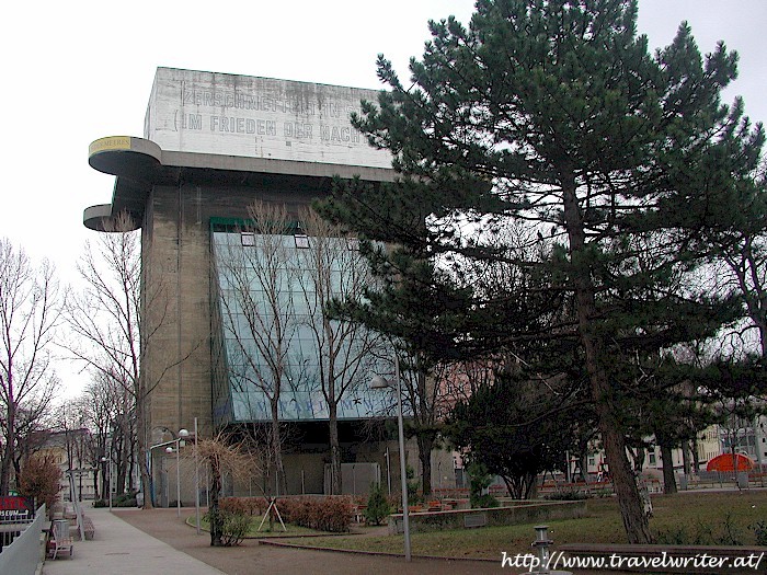
b) Concord recently assumed ownership of the 5,028-acre inland portion of the old Naval Weapons Station (NWS) and has begun the process of planning transit-oriented development there to re-use the facility. Removing the many bunker structures could prove difficult, in Vienna (Austria) city officials eventually discontinued efforts to dynamite the five remaining WW2 era anti-aircraft towers. One was converted into an aquarium.

Right now, no standard gauge rail station is planned even though the tracks for one are already there. Perhaps the locals don't want dirty diesel FRA-compliant behemoths in their near new district or perhaps, the US Army isn't prepared to permit additional passenger trains through the tidal area (Port Chicago), which it took over from the Navy.

If Concord were to change its mind, BART could decide to truncate its regular line at North Concord and use the already-present tail track there to turn trains around. After converting the existing tracks to standard gauge, eBART could exit the freeway median and dead-end in a new station at the western edge of the NWC, right next to the one for BART. So far, this doesn't make any sense at all: re-gauging is expensive and, instead of a cross-platform transfer from diesel to electric rolling stock, passengers would have to walk a short block between the platforms of the two stations.

However, since eBART remains unfunded anyhow, there is method to my madness:

By extending the tracks to south Stockton via the BNSF ROW and adding 25kV AC overhead catenaries, Contra Costa county would gain a valuable connection to the already-planned phase 2 HSR spur up to Sacramento. Getting up to Sacramento or down to SoCal would then become a snap, no long drives or BART rides to OAK or SFO required. The central and eastern parts of the county would still be a part of the Bay Area but also enjoy proximity to the rest of the state - maybe even Las Vegas one day. Note that commercial passenger service into Concord's Buchanan Field was terminated in 1992 in response to a noise ordinance, it is now only used for general aviation.

The western portion of this connector would be shared by eBART and HSR trains, with a suitable speed limit.

To make the connection happen, an aerial would have to be constructed in Oakley/Brentwood. My map shows an alignment along Lone Tree Way but that's just a suggestion. Running tracks above any city street in a semi-rural town is a sensitive topic in terms of environmental impact. Multiple alignment variations would need to be studied. The objective is to provide the missing link between the hwy 4/160 interchange and the BNSF ROW. In return for permitting this structure, eBART would terminate in Oakley instead of Antioch. This station would serve both Oakley and Brentwood.

Instead of diesel multiple units, eBART would be based on non-compliant electric ones similar to those Caltrain intends to use. Both single-level and bi-level models are available from various vendors. However, support for bi-level rolling stock depends on the available vertical clearance in the short tunnel to the freeway median in North Concord. The gradient there is also critical, as HSR trains are limited to 3.5%. BART trains are even lighter per unit of length than HSR trains and, equipped with motors that permit larger gradients.

HSR trains trains would only stop in Antioch and North Concord, both stations would be built with full-length platforms. The best location for the Antioch station would be up to that city, I just picked A Street as a placeholder. Same for Oakley. The Pittsburg/Bay Point station would be retained for eBART service.

Note that the phase 2 spur up to Sacramento depends on UPRR ROW through Stockton and within the state capital. If CHSRA ends up partnering with BNSF between Bakersfield and south Stockton, getting to North Concord would just be a matter of keeping going across the flood plain. The wye on the map below would then look a little different. Who knows, with UPRR taking a hard line on its ROWs, North Concord could even be part of the HSR network before Sacramento is.

Note that BART could implement eBART as planned, but with elevation transitions that are already compatible with HSR: 3.5% maximum gradient, 6 mile vertical curve radius. That should not be a problem since the DMU equipment the current plans call for can't handle large gradients, either.

The truncation of the regular BART line plus re-gauging of the existing tracks would be deferred until HSR actually comes to the county. The objective now would be to avoid a design that would preclude that option just to cut a corner. The critical decision here is if the city of Concord wants to retain the option of constructing a standard gauge station for eBART/HSR station opposite North Concord BART at some point in the future. That option would still be easy enough to include in the urban plan right now, the station area could be designated as a park for now. That park would later be replaced by a publicly accessible green roof on top of the station building, which would also keep the platforms in the shade.

However, the location of the eBART/HSR station area and the design of the future building would need to take pedestrian traffic between the BART station and the new district into account. Having to climb over a tall building would be a barrier to mobility, so the platforms may well end up underground. HSR needs full-length (1/4mi) straight platforms and in this case, they would need to be as close as possible to the BART station. The eBART trains will be much shorter.

Side note: AnsaldoBreda, an Italian manufacturer of both transit and high speed rail vehicles, has an assembly plant in Pittsburg.

On the following map, the truncated regular BART line is shown in red, the new eBART/HSR line and station in blue, the inland portion of the NWS in yellow. Note that only the area near the BART station will be used for transit-oriented development. The eastern and southern sections will be open space preserves. Please see the reuse project website for details.


View HSR to North Concord in a larger map

Tuesday, September 1, 2009

Fear and Loathing in San Jose

NOTE: We've moved! Visit us at the California High Speed Rail Blog.

by Rafael

We can't stop here. This is bat BART country.

The recent Initial Ruling On Atherton vs. CHSRA highlighted the issue of ROW acquisition, especially if that might involve exercising eminent domain. There's been a lot of speculation about the possible implications for the route out of the Bay Area and even the project as a whole. However, the plain truth is that it's now up to the judge to spell out the remedial actions CHSRA must take to bring the program level of its EIR process for the Bay Area to Central Valley section back into compliance.

One aspect that will surely have to be addressed is the issue of exactly where and how to run dedicated HSR tracks between San Jose Diridon and Gilroy, a topic I'll explore below. First though, let's recap why CHSRA preferred a route that goes through San Jose at all.

Economic Objectives

San Jose likes to bill itself as the "Capital of Silicon Valley", which actually stretches from San Jose all the way up to San Mateo and across to Cupertino. Much of the so-called "Golden Triangle" portion, bordered by US-101, I-880 and CA-237, actually lies in Santa Clara and to a lesser extent, in Milpitas. However, most of Silicon Valley is chock-full of high-tech computer hardware and software companies, ranging from highly innovative startups to global leaders in the computing and internet industries. Along with agriculture and the movie/TV industry, Silicon Valley is a primary economic engine for the state.

Both directly and indirectly, tax revenue from these companies and their workforce will contribute a large fraction of the funding for the California HSR project. Paradoxically, wealth is both why HSR has to serve Silicon Valley and why CHSRA is facing opposition to an alignment with elevated sections in the SF peninsula.

San Jose has about a million residents, making it the country's tenth-largest city. However, a significant fraction of Silicon Valley's highly skilled workforce neither lives nor works within city limits, a situation San Jose's civic leaders would like to change. The General Plan shows the location of these limits and also the city's development pattern. Most of the built-up area is "medium low density residential", though there are some higher-density developments here and there. A sizeable area just south-east of the SJC airport is blighted by aircraft noise and FAA-imposed maximum building heights. It is used by the US Army and for Guadeloupe Park.

The Diridon station lies just west of the flight path and, high-density residential housing has been/is being built just west of it. However, except for Caltrain's CEMOF maintenance facility and the HP Pavilion, long-standing efforts to attract commercial development between the station and CA-87 haven't been as successful. Back lots and at-grade parking lots are plentiful. Caltrain ridership into and out of Diridon station has historically been low for that very reason. In conjunction with the BART extension, HSR is supposed to deliver what Caltrain never could: attract commercial and residential development to the mid-town and downtown areas within approx. 1/2 mile of the station.

Note that neither HSR nor the long-sought BART extension are fully funded at this point and that there's no reason to believe airport blight will abate.

Transit Oriented Development

Nevertheless, San Jose is giving this another try and hosting a visioning workshop for the Diridon station area:

Date: Saturday, Sept. 12, 2009
Time: 9:00-12:00
Location: Parkside Hall, Room B (west of Tech Museum of Innovation), 180 Park Ave

(Note that as reported earlier, the Innovation Place HSR Workshop in Palo Alto will be held on the same day from 9:00am-3:30pm. See also Clem's post Palo Alto Innovates)

Separate plans for transit-oriented development already exist or are in development for Santa Clara, Beryessa, Fremont Warm Springs, Union City and Fremont Centerville (context: Dumbarton Rail + Amtrak CC/ACE). All of these are supposed to boost ridership into the downtown-midtown area of San Jose and, to connect to HSR at Diridon station.

HSR Phase 1: San Francisco, San Jose and Points In-Between

Whether all of these plans for rail transit and transit-oriented development will come to fruition or fail to attract sufficient funding remains to be seen. However, while the wording of AB3034 would technically permit CHSRA to exclude San Jose from phase 1 or even from later phases, any attempt to do so would face massive political opposition on account of the above. Note that the bill, which was the basis of prop 1A(2008), specifically requires the starter line of the HSR network to terminate at the San Francisco Transbay Terminal. Therefore, terminating it San Jose for now as some have proposed would require the state legislators to amend the bill with a 2/3 majority in both houses and probably, a new ballot proposition to approve that amendment. San Francisco would never allow that to happen.

Ergo, for all intents and purposes, both SF and SJ need to be served by HSR in phase 1. The most straightforward way to do that is to leverage the PCJPA's Caltrain ROW and cross over into the Central Valley via Pacheco Pass. Since Caltrain "baby bullet" service takes 57 minutes between these two cities and AB3034 explicitly mandates that express HSR trains do it in just 30, the plan of record is to quad-track the entire ROW, even though narrow ROW sections such as downtown San Mateo present major engineering challenges if eminent domain is to be avoided at all costs. A second complication is that even if FRA gives Caltrain a waiver to operate mixed traffic (new non-compliant electric EMUs + a few legacy diesels for SJ-Gilroy + UPRR freight trains) at up to 79mph, it almost certainly won't give CHSRA the same luxury in the related but separate "rule of special applicability".

So, for both regulatory and capacity reasons, the intent is to upgrade the Caltrain corridor for mostly two tracks to a full four everywhere. Building just HSR tracks in another peninsula corridor, US-101, was considered but rejected due to constructability issues (lack of available medians) and because the corridor doesn't run near the desired stations. Also, this option would have done nothing to fully grade separate and electrify Caltrain, nor could peninsula residents have transferred to long-distance HSR trains at selected stations between SF and SJ.

Approaches into San Jose Diridon

South of San Tomas Expressway in Santa Clara, CHSRA's Google map of the route (please zoom in) shows an expensive trench/tunnel section to just north of SJ Diridon. Presumably, that's just two tracks reserved for HSR, so Caltrain would remain at grade (it's already grade separated in the area). Also note that the HSR tracks need to cross over or under the UPRR tracks somewhere between Santa Clara and Gilroy. Doing so in Santa Clara isn't possible because the BART tracks will run east of UPRR's line as far south as West Santa Clara Street, immediately north of Diridon station. Present plans therefore call for HSR to stay west of the Caltrain tracks. Note that tracks will need to emerge to the surface north of W. Julian St. since that's an existing underpass and tracks need run length to fan out to the platform tracks on the new deck above the Caltrain/UPRR tracks.

CHSRA's plan of record calls for a mix of aerials, embankments and cut/fill sections to cross I-280 and reach Gilroy via the UPRR/Monterey Hwy corridor. In some sections, the UPRR ROW might have to be widened via acquisition of land or air rights from private property owners - via eminent domain if need be. Failure to qualify the risk of such takings was one of the complaints the judge upheld in Atherton vs. CHSRA.

The track fan south of Diridon station can merge west, east or directly above the UPRR tracks, as desired. However, note that W San Carlos St. is currently an overpass. It would have to be converted to an underpass to keep HSR tracks from having to change elevation yet again. However, there's probably a good reason is was built as an overpass to begin with. Also, it's not clear if all of the HSR-related grade separation works shown on CHSRA's Google map are strictly for the new HSR tracks or would also include the legacy tracks used for UPRR freight, Caltrain and Amtrak Coast Starlight. By default, the latter might be preferable, but also much more difficult to construct (shoofly tracks). Given the low total volume of FRA-compliant traffic between San Jose and Gilroy - just 6 freight, 6 Caltrains and 2 Amtrak trains - it may well be acceptable to retain grade crossings for the legacy tracks only.

Since UPRR declined to entertain an offer because of supposed safety concerns, it cannot credibly pretend they've magically gone away even CHSRA were to offer it the moon. At the very least, there would have to be some engineering studies to determine if a given implementation proposed by CHSRA meets UPRR's criteria, which it hasn't even spelled out yet. This could drag on for years even if price were no longer an issue.

Ergo, UPRR's decision not to offer up any of its ROW nor air rights above it south of Lick (Caltrain's Tamien Yard, just north of Almaden Expwy/87) means CHSRA will have to secure land/air rights nearby, if only to avoid delaying the project. This will be tricky to achieve without eminent domain, especially near the gated communities just south of Curtner Ave, which is an overpass. Note that a VTA light rail line runs in the CA-87 and CA-85 medians.

Alternative to the UPRR ROW

However, the medians of both I-280 and US-101 are still available. Freeway medians are usually narrow, possibly limiting the maximum safe speed to below what CHSRA was counting on for a given section of the route. BART trains aren't constrained, but then their top speed is 79mph to begin with. As always the devil is in the details, i.e. exactly how many feet of width are available. Google Map's satellite view doesn't provide that level of precision.

The hardest part would be the section between W Santa Clara St and just east of the gnarly I-280/CA-87 interchange. Overpasses there may not be tall enough to permit HSR trains to run underneath, so it's better to avoid it altogether. In addition, HSR trains are limited to gradients of 3.5% and need generous curve radii at elevated speeds, so an entry point west of the interchange would be ambitious.

A deceptively simple solution would be to keep the HSR tracks underground south of CEMOF all the way to east of the interchange. Once you've bitten the bullet and gone underground, there are advantages to staying there. However, it would also put the SJ station underground, with full-length (1/4mi) platforms placed at an angle relative to those of both Caltrain and BART. There would be no need for architectural Viagra on the surface, not that need ever had anything to do with it to begin with. However, in raw transportation terms, an underground station with as little as two run-through tracks and one large island or two generous side platforms would get the job done. Fortunately, the area is partly parking lots and the aforementioned visioning workshop - a very early stage of the urban planning process - hasn't even happened yet.

There's plenty of room to run west of the BART tracks curving around the HP Pavilion, but the HSR tracks actually need to run sufficiently deep to pass under the VTA light rail line that already crosses under the Caltrain/UPRR tracks. HSR would also need to cross under the Guadeloupe River, a residential district, CA-87 and a second creek before emerging in the I-280 median. Note that the HSR tracks would also need to run either west of or else under the future BART tracks.

In other words, the HSR line and platforms would have to be very deep underground anyhow. Since San Jose is a through station anyhow, perhaps a single extra-wide island or two generous side platforms would actually be sufficient. Trains run past platforms in Europe and Japan at fairly high speed all the time. Waiting passengers are simply warned to retreat to a safe distance via the PA system and markings on the floor. The VTA tracks would prevent a full concourse level, but none is needed anyhow. Multiple pedestrian connections to the surface, to BART, Caltrain and the VTA station would be sufficient. Some of these passages could feature moving walkways to reduce transfer times. ADA compatibility would be achieved via elevators, but ramps or inclined moving walkways are more reliable in case a wheelchair user needs to be evacuated.

At the anyhow pre-blighted I-280/US-101 interchange, the cheapest solution would be a tall aerial to transition between the medians. However, it would have to fly over a descending overpass lane, so it would be a tall structure. Still, the incremental visual and noise impacts should be minor. The alternative would be to execute the transition underground, but that's more expensive.

Optional Extension through Altamont Pass

Tunneling under the I-280/US-101 interchange only makes sense if there is a desire to leverage all the work that was put into reaching the I-280 median for something else: a turnoff to continue east to I-680, whose median is also still available - all the way to the foot of the Sunol grade in Fremont, actually.

If Caltrans is prepared to reserve that median for HSR trains, it could be the basis for a future shortcut to Sacramento via Altamont Pass. Between Scott Creek Rd and E Warren Ave in Fremont Warm Springs, the tracks would veer east and across to Haynes Gulch via a long tunnel under Monument Peak. There, they would veer north, running essentially at grade next to Calaveras Rd. as far as the CA-84/Calaveras Rd exit off I-680. An aerial across the CA-84 and another tunnel would lead the tracks to an intermodal with BART at El Charro Rd in east Pleasanton/west Livermore. It would be heard to avoid impacts on both the nearby ponds and Livermore Municipal Airport, since crossing at grade is not feasible because of UPRR. Altmont Pass would be traversed - except for one short section - via the I-580 median. Passing north of Tracy, tracks would connect to the phase 2 spur to Sacramento near either Manteca or Escalon.

Optional Extension to Walnut Creek

Note that the I-680 median is still available between just north of the CA-84 exits to just south of the CA-24 interchange in Walnut Creek. A tunnel section under California Blvd. would be needed to create an intermodal with the BART station. However, that road features a tight chicane and there is a medical center next to the freeway. Tunnel tracks would have to thread a needle between its buildings. This would require a technical feasibility study as well as the consent of Kaiser Permanente regarding any number of issues, including construction nuisance and vibrations from passing trains. Eminent domain against a hospital is basically unheard of, so I'd consider the whole thing a long shot. However, even without an intermodal with BART, there would at least be HSR service to eastern Alameda and central Contra Costa county.

Maps for Alternative #1

The alternative ROW and extension options are shown on the map below. Switch to satellite mode to see why the HSR station would have to be deep underground. Zoom out in map mode to see the regional implications. Switch to terrain mode to see where there are mountains to contend with.

The picture below the map shows location of major known faults - basically, Calaveras Rd. and I-680 north of Sunol are right on top of the Calaveras fault. The Hayward fault generated the 1868 earthquake, estimated at 6.8 on the Richter scale. Paleoseismologists have estimated the mean time between such events on that particular fault to be 140 years, so statistically, it's due right around now. Perhaps it's not the most auspicious time to build a railroad, but the people of California have never allowed themselves to be paralyzed by a fear of Mother Nature. See our earlier post Shake, Rattle And Roll for more background on earthquake engineering in the railway industry.


View San Jose Diridon: HSR Underground in a larger map


Alternative #2

Since we're talking hypotheticals anyhow, here is a second alternative based on using 101 between SJ and Gilroy.

To come up with this one, I started in Gilroy and worked my way north. It quickly became apparent that the problem in San Jose could be addressed by simply moving the HSR station to the huge transit-oriented development at Beryessa and continuing north up the East Bay instead of the SF peninsula. CHSRA did study the scenario of SF + Oakland + SJ via Pacheco but not along this particular right of way, which does not depend on UPRR but precludes extending BART south. Moreover, whatever is gained in San Jose is lost (and then some) because the only available unused railroad right of way runs from Union City to just north of Oakland Coliseum. Reaching it from Fremont Irvington with full grade separation requires tunnels in Niles, tiptoeing around the water supply for 100,000 people.

The aforementioned available ROW runs right next to BART, but unfortunately its tracks cross over in three locations. That would greatly complicate the vertical alignment, though at least heavy freight does not impose any gradient constraints.

North of Oakland Coliseum, a few miles of greenfield ROW immediately next to BART would be required, complicated by the Fruitvale station and transit village. A tunnel under the Lake Merritt outflow and 4th Street in Oakland would need to pass under the east portals of the Webster/Posey road tunnels across to Alameda. The upside is an elevated intermodal station with West Oakland BART. Sanity would dictate that HSR terminate here in phase 1, after all downtown SF is just one BART stop away. However, as discussed above, AB3034 mandates a terminus in San Francisco Transbay Terminal. Since the station there is in the basement and the new east span of the Bay Bridge was redesigned specifically not to support the weight of BART/light rail/HSR trains, a second transbay tube would have to be part of the phase 1 specifications. Note that it could not cross the existing tube underwater.

As a result of all this, switching to the East Bay would be no easier than sticking with the peninsula. Multiple hard-fought political decisions would have to be reversed, multiple EIS/EIR processes re-done. Whatever ARRA is available for California HSR would be spent elsewhere in the state.

Summary:

- HSR up 101 from Gilroy ($)
- modest elevated San Jose HSR station at Beryessa TOD ($)
- VTA's WPML ROW used for HSR (priceless ;^)
- tunnel in Niles to reach UC BART (stacked single tracks, $$)
- dedicated HSR alignment next to BART ($$$, ROW incomplete, BART crosses three times)
- tunnel under Oakland's Chinatown ($$$)
- second transbay tube to San Francisco Transbay Terminal Center ($$$$)

Consolation prizes:

- BART extended to Livermore via I-580 ($$)
- Caltrain electrification SF-SJ Diridon ($$)
- VTA light rail subway under E Santa Clara St and up to Beryessa via track stacking on short section of WPML ($$$)

Canceled: BART to Santa Clara (-$$$$)
Canceled: BART maintenance facility in Santa Clara (-$$)
Canceled: widening Caltrain corridor (-$, -litigation-related delays)
Canceled: Dumbarton rail (ROW in Union City usurped by HSR) (-$$)

Shelved indefinitely: DTX tunnel in San Francisco (-$$$)
Pushed back to PCJPA: full grade separation of Caltrain corridor (-$$$)


View HSR up WPML instead of BART in a larger map

Basically, this Alternative #2 was an interesting exercise, but it would really put a pride of lions among the pigeons. The takeaway is that switching to the East Bay would solve some political issues in the mid-peninsula at the expense of a whole new set of headaches.

Alternative #1 is more limited in scope, it "just" completely reconfigures the SJ station and moves the one in Gilroy to the 101 median.


UPDATE: Alternative #3: Commenter BruceMcF (h/t) has suggested that stacking HSR and VTA light rail tracks in the 87/85 medians between Lick and the Santa Teresa district would be both feasible and cheaper than the alternatives discussed above.

There are multiple existing road overpasses, including Almaden Expressway and Blossom Hill Rd. next to the station there. The stacked tracks would have to fly over those, raising tracks very high. VTA light rail leaves the 87 median and forks tracks at Ohlone Chynoweth station next to the 85/87 interchange. It leaves the 85 median in the Santa Teresa district. Combined with station access issues, this favors stacking the HSR tracks on top of light rail.

However, that puts the (slightly) heavier HSR trains on top and increases noise emissions. HSR's maximum gradient is smaller than the one light rail vehicles can negotiate and, greater vertical transition radii are needed on account of the higher speed. Note that VTA light rail is triple-tracked in some sections and would be down to just two after the project. Separately, note that the 101 median is not available right at the 85/101 interchange but that land for tracks to hug the northbound on-ramp is. At an appropriate point further south, the alignment would cut back over into the median.

Note that VTA's daytime light rail operations would need to continue during the construction period.


View SJ Diridon to Gilroy via UPRR/87/85/101 in a larger map

Saturday, August 15, 2009

Introducing the Golden Gate Mariner

NOTE: We've moved! Visit us at the California High Speed Rail Blog.

by Rafael

This post is about an ambitious idea I had for a new regional light rail/streetcar line between downtown San Francisco and San Rafael in Marin County. While the primary purpose would be local and regional transit for residents of Marin county, it would also connect both them and Sonoma county residents (via connection to SMART) to high speed rail at the future Transbay Terminal Center.

A Brief History of Transit between SF and Marin County

Early in the 20th century, the only way to cross the Golden Gate Strait was with a ferry from piers along the SF Embarcadero to either Sausalito or Tiburon. From there, a standard and a separate narrow gauge railroad provided connecting passenger service to points north.

When the Golden Gate suspension bridge was designed to accelerate transit, the plan was to support streetcar service on two of its lanes. However, the actual construction never featured any rails because there was never anything to connect them to at either end. By the late thirties, transit agencies were switching to diesel buses which were more flexible and cheaper to operate. That is still the case today, but bus ridership suffered greatly once just about everyone could afford cars of his or her own. For a variety of reasons, electric trains - especially grade-separated subways - tend to be more popular with commuters.

The principal problems the popularity of private cars created for urban planners are road congestion and land use for parking spaces. Congestion also impedes bus and streetcar operations. Air quality issues related to gasoline cars have receded thanks to three-way catalysts. Comparable technology for diesel engines is much more expensive and was not even available in California before late 2008.

In a rare example of prescient regional transportation planning, an Army-Navy board convened after WW2 recommended the construction of a fully grade separated electric rail network spanning San Francisco, San Mateo, Marin, Alameda and Costra Contra counties. Since only the lower deck of the western span of the Bay Bridge had been constructed to support trolley service from the East Bay to the SF Transbay Terminal, the whole bridge was to be given over to motor vehicles. The new trains would run out to Daly City in a subway under Market Street, with a fancy new transbay tube across the Bay. Soon after, this plan became the basis for the civilian BART organization.

San Mateo soon bowed out, citing the high cost of full grade separation required to enable third rail operations. In addition, Standard Pacific already provided diesel-based passenger rail service into San Francisco. Keep in mind that at time, this was profitable, the peninsula was sparsely populated and no-one had even conceived of Silicon Valley.

BART engineers had picked 1676mm broad gauge for the new network, in part to provide mor stability for the planned Marin line across the Golden Gate bridge. Marin county withdrew from BART regardless. The primary reason was its limited tax base, but there was also some renewed discussion of whether the Golden Gate bridge could support the BART trains, which are longer than streetcars (though lighter per unit length, which matters more for bridge safety). Up to a point, the engineering discussion may have been a bureaucratic smoke screen: the Golden Gate Transit Authority was jealously guarding its turf, which included the bridge and toll collection on it.

Right of Way Preservation Efforts

Marin county did spend quite a bit of time and money on studies related to the old railroad lines, whose fortunes had declined due to competition from US 101, increasing opposition to logging in old-growth temperate rainforests, tunnel fires and the high cost of maintaining the Eel River valley line up to Eureka. Certain sections are prone to flooding and/or geologically unstable.

The county and its neighbor to the north, Sonoma, ended up purchasing the right of way between Corte Madera and Ignacio, just south of Novato Junction. Between Corte Madera and Sausalito, the old right of way is being preserved as a bike route called the North-South Greenway. Bicycles are serious business in Marin: millions are currently being spent on restoring the old railroad tunnels, something cyclists in Santa Cruz county can only dream of. Parts of the old line between Corte Madera and Tiburon are also being preserved as bike trails today.

The section between Schellville Junction (south of Sonoma town), Novato Junction and Eureka was taken over by the North Coast Rail Authority (NCRA), a California state agency created specifically to keep the ROW from being abandoned. In 2006, it leased the right to operate to the resurrected Northwestern Pacific Railway (NWP). It intends to minimally rehabilitate the line - top speed 10mph in some sections - to support the extraction of aggregate from the Eel River valley. Tracks still exist between Schellville Junction and Fairfield Junction with the Capitol Corridor main line, though they will also need to be rehabilitated before they can be brought back into service.

Coming full circle

In retrospect, many North Bay residents now regret Marin's 1961 decision to withdraw from BART. The Golden Gate bridge is now badly congested during rush hour, tolls have since risen to $6 southbound and all-day parking in SF has also become very expensive.

In 2008, a 2/3 majority of combined Marin and Sonoma county voters approved a sales tax hike to fund the resumption of passenger rail service between Cloverdale and the Larkspur ferry terminal under the name SMART (Sonoma-Marin Train). To preserve the option of double-tracking at some point in the future, a bike trail will run next to the restored line. Detractors rightly point out that that any future service to Sacramento and Oakland is just a pious hope at this point. For the moment at least, Marin county in particular is heavily dependent on its tenuous connections to San Francisco and Berkeley.

There is also concern that NWP's plan to support controversial mining operations in Mendocino county will lead to numerous heavy freight trains running through multiple Sonoma county towns at night, just to avoid conflicts with SMART's timetable during the day. NWP has already begun with rehabilitation work, so SMART may be forced to select FRA-compliant equipment such as DMUs from Colorado Railcar, which had briefly gone out of business in 2008.

Choosing FRA-compliant equipment would essentially kill whatever hint of a sliver of a chance there remains of ever laying heavy rail tracks south to Marin City, never mind Sausalito. Tracks across the Golden Gate and into downtown San Francisco seem even more outlandish.

Streetcar vs. Car, Sweet Car

Still, it's worth re-iterating that the Golden Gate bridge is badly congested, a situation that is unlikely to improve by itself anytime soon, if ever. FasTrak toll collection has certainly helped speed things along, but there are still plenty of people who prefer to pay cash. Restricting two lanes on 101 between San Rafael and the Marina district in SF to HOV vehicles would obviously increase throughput capacity, but it would also make commuting even more hellish for anyone who cannot - or will not - carpool. Private livery service is expensive and public buses not terribly popular.

One possible approach would be to forget about the Larkspur Ferry and terminate SMART in San Rafael instead. There, passengers would make a cross-platform transfer to a new light rail service which I've dubbed the "Golden Gate Mariner".


View Golden Gate Mariner (light rail) in a larger map

Provided cyclists agree to share the ROW as they already have for SMART, light rail should be compatible with current land use patterns in southern Marin county. The one significant caveat is that the old level railroad bridge across the Larkspur slough should be replaced. For a transit service that will run multiple times per hour, any swing or bascule section represents a risk to the timetable. The replacement should provide as much clearance as the adjacent freeway bridge. Fortunately, suitable light rail vehicles can handle grades as steep as 6%.

Service through Sausalito would be in streetcar mode. South of that point, there are two options:

OPTION #1 is to climb up to the Golden Gate bridge, run across that into the Presidio and head for the Marina District via Chrissy Field. Beyond that, trains could continue past Fort Mason to join up with the F-Market streetcar tracks along the Embarcadero, possibly hooking a left at 1st & Market to reach the new Transbay Terminal Center and looping back via Fremont Street.

The big plus of this option is that it avoids seriously breaking the bank by leveraging the existing Golden Gate bridge. It would not be necessary to dedicate lanes to streetcar service, only to ensure sufficient space in front of and behind the heavy light rail vehicle to avoid collisions and exceeding local load limits. In practical terms, that would not be easy to do. Railroads use block signaling, perhaps something comparable (but with very short blocks) could be used in this context. The streetcar lane could be monitored with video cameras, anyone running a red light would be fined.

This highlights the primary downside: sharing the existing bridge without dedicating one or two lanes to trains means inconveniencing motorists, even a potential safety hazard. Theoretically, light rail service would take more than enough cars off the bridge to compensate for the inconvenience. In practice, however, vehicle traffic volume tends to rebound before long as the population grows.

The other downside is that light rail is limited to low speeds in streetcar mode. The total distance for option #1 is only 20.8 miles, but it could take an hour to cover that distance.

OPTION #2 avoids the Golden Gate bridge, relying instead on a brand-new, dead straight tunnel under the Golden Gate between downtown Sausalito and Columbus Ave in SF. At 5.5mi, this isn't the shortest option for a bay crossing, but it does run along a ridge on the sea floor, this limiting how deep the tunnel would need to run.

The line would continue up Columbus Street in SF and joining up with the northern end of the Central Subway. Sharing track with that would require schedule integration, as SF Muni currently plans to run the Central Subway at 5 minute intervals during rush hour. If sharing is possible, the GG Mariner would connect to BART / SF Muni at Powell Street and to Caltrain at 4th & King/Townsend.

It would be possible to terminate the line at 3rd & Channel in Mission Bay. However, it would be useful to offer direct service to the TTC. Given that the complex vertical alignment of the Central Subway (option 3B per FTA's ROD), the only way to achieve that is with some new streetcar tracks to double back. The earliest opportunity would be Bryant Street just south of the portal, but it's a one-way street. It might make more sense to use SF Muni's existing tracks along King and Embarcadero, run past the ballpark and up 2nd (above the DTX tunnel). The line would end in a single-track loop via Natoma, 1st and Howard.

Still, single biggest advantage of option #2 would be the shorter distance and much straighter alignment into downtown SF and out to 4th & King. Line haul time from San Rafael could probably be reduced from an hour to less than 40 minutes. That would be a game changer in terms of modal market share among commuters. Compared to that, the awkward detour to get to the TTC is a small price to pay. In addition, option #2 would create a second fixed link across the GG strait, a very useful thing to have in case the Bridge or US-101 ever became unavailable for an extended period of time, e.g. after an earthquake.

The biggest downside, obviously, would be the fairly stupendous cost of constructing a bored tunnel under the Bay. The distance is much shorter than the one between England and France, but the ridership potential is also much smaller. There just aren't that many people in Marin county (or even Marin + Sonoma counties). A submerged floating tunnel, anyhow just a theoretical concept, is probably out of the question due to the high tidal currents in the Golden Gate.

Perhaps a conventional immersed tube might be viable, as long as it is buried deep enough to avoid undesirable interactions with the currents.

Rolling Stock and Yard

Since both options require a certain amount of streetcar service and would share some track and stations with SF Muni lines, the trains cannot be too long.

Regional light rail lines of similar length with sections of mixed traffic with local streetcars operate successfully in Europe, e.g. the WLB between Baden and Vienna, Austria. Their dual track line is 30.4km (19mi) long with a total of 34 stops, roughly comparable to option #1 above. WLB has run on overhead catenaries for over a century and serves 30,000 passengers a day at intervals of 7.5-30 minutes (varies by day, time of day and location). That corresponds to a modal share of ~40% of commuters, even though there is no single traffic choke point comparable to the Golden Gate bridge. Ticketing is integrated with the zone system used by the regional transit authority VOR.

WLB's new type 400 rolling stock is a custom low floor variant of Bombardier's Flexity Swift light rail product line. Each car is 27m long, doubly articulated, weighs 49 metric tonnes fully loaded and offers around 70 seats plus room for well over 100 standees. Typical trains feature 2 cars back-to-back, with the driver cabs at the free ends. For reference, WLB also operates some light freight trains on its own heavy rail tracks south of Schedifkaplatz and those of other railways.

Note that overhead catenaries and conductor rails (for low tunnels) are expensive but don't require full grade separation. For option #2, OCS is the only way to go. Option #1 could be theoretically implemented with a clean diesel powertrain as well, since the only tunnel is the short one in Mill Valley. Also, any proposal to add sturdy OCS poles and wire to the iconic GG bridge might well run into environmental objections.

Since most of the morning ridership on the GG Mariner would be southbound, it might be acceptable to make do with a single yard for overnight parking. The easiest location for that would be at the end of a short spur in Corte Madera, see map above. The location used to be part of the NWP line to Tiburon. The last trains of the day would dead-head there from San Rafael.

Friday, June 5, 2009

Special Elections Have Consequences

NOTE: We've moved! Visit us at the California High Speed Rail Blog.

by Rafael

Future HSR feeder services cut back, raise fares

The San Francisco Chronicle reports today that Caltrain will raise fares and cut service:

The board took no action on the $99.4 million budget plan Thursday - that will come later this month or early next month - but voted unanimously to declare a fiscal emergency. That move allows the transit agency to bypass state environmental reviews and enact service cuts and fare hikes at an accelerated pace.
The decision follows similar ones by BART, SF Muni and AC Transit in the East Bay. Squeezed by cuts in the state budget, reduced commuter ridership and lower sales tax revenues at the county level, all of these bureaucrats essentially have no choice but to increase revenue and/or cut services to plug rapidly expanding holes in their respective budgets.

Down south, Metrolink is also raising fares, but LA Metro will maintain both fares and service levels in FY2010. Indeed, it boasts of service enhancements, even as it cuts expenses by $130 million and taps into reserves. Note that many of these "enhancements" are actually cuts in selected bus routes.

NCTD also intends to maintain both service levels and (most) fares in the coming fiscal year, having already implemented cuts and fare hikes in the current one. MTS in San Diego has passed a framework budget but warns of further cuts to come as it fills in the details.

The mixed picture suggests that Southern California, long considered a bastion of the automobile, now actually has a mass transit network in better fiscal health than the Bay Area. However, the reprieve will only be temporary if the recession last longer than expected.

Special elections have consequences

Amtrak California aka Caltrans' Division of Rail is funded by the state of California, which is all but bankrupt. Since voters rejected a delicate compromise in a complex package of propositions put to them last month, chances are subsidies for the Pacific Surfliner, Capitol Corridor, San Joaquin may well be slashed severely in coming weeks as lawmakers in Sacramento figure out how to balance their budget through cuts alone. Unfortunately, while service cuts and/or fare increases are required at multiple levels in the short term, they also set in motion a vicious circle of ever-decreasing ridership and ever-greater traffic on the state's highways. That's exactly the opposite of what is required for a sustainable recovery and population/economic growth in the long term.

Of course, California is hardly alone in its budget woes, but very few states require a 2/3 majority to pass a balanced budget. Considering its population now exceeds that of Canada, which requires just a simple majority, perhaps it's time to admit the obvious and amend the pertinent sections of the state constitution in 2010 such that the change is hard to reverse. You can either have high taxes and high-quality public services (e.g. dense transit networks at multiple distance scales) or, low taxes and few public services. The other permutations are simply not sustainable, there is no tooth fairy and also no prospect of reasonable compromise.

Having sole authority and responsibility for balancing the budget tends to concentrate the minds of politicians on both sides on drafting feasible, coherent multi-year policies instead of engaging in ideological trench warfare. In addition, there could well be a drop in the number of spending decisions taken via single-issue ballot propositions, especially expensive ones without a dedicated revenue stream. And yes, while I am in favor of California HSR, I do believe direct democracy was a bad way to get it off the ground. Such mega-projects ought to be proposed and promoted not by bureaucrats but by elected officials who are directly accountable to the people.

Turning a vicious circle into a virtuous one

Meanwhile, Secretary of Transportation Ray LaHood is trying to plug a hole of his own in the federal highway trust fund. With healthcare and electricity infrastructure high on the President's domestic agenda, it is possible the next major transportation bill won't be passed before the 2010 midterm elections. For now, expect Congress to kick the can down the road, i.e. to take on more debt rather than raise federal fuel taxes, a concept that is widely perceived as politically impossible. Then again, so was electing an African-American POTUS a couple of years ago.

However, at some point, both the state of California and the Obama administration will have to reconcile their lofty ambitions of green energy and transportation systems with the hard reality that investments in such infrastructure will only pay off if perpetuating the status quo becomes prohibitively expensive for private businesses and consumers alike. No pain, no gain. Both should cut other taxes if and when they can, but they really need to ramp up those on petroleum-based fuels to gradually reduce total vehicle-miles traveled per capita, to partially shield consumers from oil price volatility and, to boost the utilization rates of fixed-cost transit infrastructure (incl. bicycle paths).

Ironically, sharply higher gas prices are also exactly what the domestic auto industry needs to increase profits per sale after it sheds excess unit volume capacity in the context of its present restructuring effort. GM in particular is risking the farm - soon to be your farm - on its expensive E-Flex architecture, essentially electric drive with an "emergency" generator to extend the range.

Meanwhile, HSR already has a proven track record of returning operating surpluses after an initial ramp-up period, overseas and even in the Acela corridor. There is every reason to believe it will thrive without annual subsidies and perhaps even cross-subsidize local and regional connecting transit operations. In the long run, HSR will prove a far superior investment to paving over ever more land with asphalt, precisely because it promotes an alternative to land development patterns that rely on cheap oil while creating additional new opportunities for the US manufacturing sector.

Monday, April 6, 2009

East Bay Blues

NOTE: We've moved! Visit us at the California High Speed Rail Blog.

No, that's not Bob Dylan on the left, but it might as well be. Of all the major population centers in California, the eastern portion of the San Francisco Bay - Alameda and Contra Costa counties - arguably drew the shortest lot. True, East Bay residents will be closer to HSR stations on the starter line than anyone in San Diego or Sacramento, but there are currently no firm plans for an HSR station in either Oakland or Union City - ever.

Moreover, the new Transbay Terminal in San Francisco will be ~1/3 mile from the nearest BART station, Embarcadero, which gets overcrowded during rush hour. TJPA's plans for a pedestrian passage under Fremont Street are still "optional" at this point and, BART has made no commitment to use any of its $241 million share of the prop 1A bonds for additional side platforms at Embarcadero plus ramps featuring moving walkways connecting to such a passage. Unless that changes, BART passengers would have to hoof it across SF city streets to the HSR station, in any kind of weather, with baggage and perhaps children in tow. AC Transit will operate buses into the building, but its unclear how many HSR passengers will take advantage of that option.

Millbrae will hopefully offer a more convenient transfer, but BART takes it's sweet time getting out to there. Worse, on any given day of the week, only one line runs out to Millbrae, so many HSR passengers will have to transfer twice. Either way, the time lost just getting to and from the nearest HSR station will mean Oakland Airport will continue to offer flights to Southern California for many years to come.

HST/Commuter Overlay

Recently, CHSRA did award a $70 million contract to AECOM, for project-level EIR/EIS work on the awkwardly named "HST/commuter overlay" that is "under consideration" (see the pink bit here). The overlay concept was introduced toward the end of the whole Altamont vs. Pacheco debate as a punt ahead of the November election. The idea is to recycle the work done on the Altamont options studied for HSR into an ill-defined regional adjunct to the core HSR network. The overlay would link Stockton and Modesto to Oakland and San Jose via Tracy, Pleasanton and Union City. There is, however, no money at all for building this overlay in either phase I (starter line) or phase II (spurs to San Diego, Sacramento and Irvine).

Moreover, the originally selected route between Pleasanton and San Jose would have trains emerging from a curved tunnel in Niles and then proceeding south via the UPRR and WPML rights of way, CA-262 and the I-880 median. Now that Santa Clara county voters have voted to add another 1/8th of a percent to their sales tax to actually bring BART to San Jose, the short but vital WPML section is no longer available. Co-operation from UPRR was always an iffy proposition anyhow, especially in Fremont. Note that Parsons Brinkerhoff are the lead consultants on both HSR and the BART extension to SantaClara/SJC. That obvious conflict of interest alone ought to speak volumes about how major transit infrastructure projects are run in Northern California.

Realistically, nothing will come of the overlay concept anytime soon. And by soon, I mean before 2030. The only exception would be if CHSRA were unable to obtain a ROW out of San Jose and down to Gilroy, e.g. because of environmental justice issues or opposition from UPRR in principle. Some observers have characterized that railroad's stance as a negotiating ploy and that may yet turn out to be true: as a for-profit enterprise, money talks even for UPRR. On the other hand, it is a long-standing, profitable enterprise that just might walk away even from a juicy deal if it thinks it could be detrimental to its core business. Time will tell.

Existing East Bay Passenger Rail Services

Meanwhile, there are already several passenger rail services in the East Bay, in addition to BART. First, there's Amtrak Capitol Corridor, which is operated by Amtrak but managed by BART (h/t to anon @ 12:50pm). It connects San Jose to Oakland to Sacramento and Auburn. The core segment between Oakland Jack London Square is served by 16 trains each way on weekdays and 11 on weekends/holidays. San Jose is served by 7 trains.

Second, there are the four daily Amtrak San Joaquins (each way) between Oakland Jack London Square (OKJ) and Bakersfield. There are also two daily Amtrak long-distance trains serving the area: the Coast Starlight between Seattle and LA and the California Zephyr from Chicago to Emeryville, with a bus connection to San Francisco.

Third, there is the Altamont Commuter Express between Stockton and San Jose, also offering four trains each way but only on weekdays.

However, this isn't quite the transit smorgasbord it may seem to some: Amtrak Capitol Corridor only connects to BART at the OaklandColiseum/OAK and Richmond stations. San Joaquins connect only at Richmond and the other standard gauge services don't connect at all. With some track work, the San Joaquins could have an intermodal station with BART in North Concord now that the Navy has returned the inland portion of the old Naval Weapons Station to the city. However, planners there appear to see no value in an intermodal station and appear to have settled on a TOD concept served by BART alone. That means the questionable eBART project to extend service to Antioch - using new DMU equipment rather than regular BART rolling stock - remains alive and kicking.

Amtrak via new Nelson Mandela Station

In particular, the OKJ station is served by a grand total of just two AC Transit bus lines, with a few more stopping 1/4 mile further west. For a city of 400,000 that is also at the geographic heart of the BART system, OKJ isn't an effective Central Station for standard gauge rail. Unfortunately, running tracks right into downtown (near 12th/Broadway) would require many miles of expensive tunneling.

Fortunately, there may be a more affordable compromise: a shortcut between Emeryville and Jack London Square via Nelson Mandela Parkway. That is a city street, so the alignment would have to run in a mostly covered trench. It has also been lovingly landscaped, something that might have to be re-done at the end of construction. The prize, however, may well be worth it: an intermodal station with West Oakland BART, just one stop from downtown Oakland and downtown SF. In addition better connections into Oakland, the point of the exercise would be to reduce line haul time between SFO, downtown SF, Sacramento and Truckee (in Winter), thus relieving pressure on I-80.


View Larger Map

While not exactly a Central Station in the traditional sense, the West Oakland location could act as a regional transfer hub. The station is currently served by three AC Transit bus lines, more could conceivably be added. There are also plenty of empty lots in the area that could support parking or taxi service if there is demand.

The biggest obstacle to construction, other than funding, would be the UPRR yard next to I-880 and 3rd Street. Passenger trains are not permitted in freight rail yards, so the alignment would have to skirt the terrain while rising back up to grade level. A couple of industrial businesses, one of which looks like a cardboard recycling center, might be affected by eminent domain as a result. Note the single track connector hugging I-880: it would only be used by southbound trains that need to return to Emeryville. There is not enough room for a dual-track loop, nor is one needed. Note that a new "Nelson Mandela" station might prompt Amtrak to reduce service to Jack London Square.

Amtrak CC: WiFi on Board

Like Caltrain before it, Amtrak Capitol Corridor recently conducted a WiFi on Board trial based on terrestrial WiMAX connections to the fixed infrastructure. The service proved much more popular than Amtrak California had bargained for. Nevertheless, the plan is to upgrade bandwidth capacity and still offer it at no charge - something that would be easy enough to do: just print a one-time password good for 2 hours on the ticket. The rationale is evidently that courtesy internet access will help boost seat capacity utilization. Stay tuned.

ACE via Union City BART

Further south, there is scope for an intermodal station with BART in Union City. There is a little-used single-track freight spur running from Industrial Parkway to Niles via Van Euw Common, right alongside the elevated BART tracks. SMCTA had already identified this possibility in the context of plans for limited commuter service across the 100-year old Dumbarton rail bridge, but this has been postponed by the suspicious 1998 fire that destroyed the western trestle and, by the need to repay a $145 million loan from the BART extension to Fremont Warm Springs that San Mateo county had to take out to pay for cost overruns related to the extension to Millbrae/SFO. Some $54 million is still outstanding, the project time line keeps slipping.

However, one opportunity appears to have been overlooked in this context: with some additional track work and trackage rights, the existing ACE service could in theory make a detour via this anyhow planned intermodal station with BART in Union City, cut over to Union Landing (I-880/Whipple Rd) and back down to Newark, as shown in green on on the map below. In addition to the BART intermodal, there would be two new stations to improve transit options for the army of Silicon Valley worker bees that sleeps in the East Bay. Like the Amtrak Capitol Corridor trains, this modified ACE route would still include a stop at Great America in the heart of the "Golden Triangle" bordered by CA-237, I-880 and US-101. BART does not and will not reach that destination.


View Larger Map

ACE to SF via Niles Canyon north slope

Shown in red on the map is the option of a new ACE service direct to additional Silicon Valley employers, Millbrae/SFO and SF 4th & King. In addition to a little bit of access track work north of Sunol and in San Jose, this would involve trackage rights from UPRR or NCRY (whichever now owns the old SP ROW along the north slope of Niles Canyon) plus trackage rights from UPRR along the Milpitas line. At the wye in San Jose, trains would head north up to San Francisco via the Caltrain ROW, in baby bullet mode. That would require trackage rights from PCJPB plus permission from UPRR, which still owns the rights to intercity passenger service on the SF peninsula. One option would be for ACE to accept Caltrain tickets on the peninsula and deduct their value from the trackage fees.

The Milpitas Line is little-used south of 101 but represents a valuable back-up route in case the Alviso line through the salt marshes ever becomes unavailable, e.g. because of an earthquake. However, any passenger rail service on this line south of 101 should implement FRA quiet zone regulations first. Of course, if and when the Dumbarton rail bridge re-opens, there could be scope for further improvements to ACE.

The bigger issues may be in Pleasanton, Livermore and especially, in Altamont Pass itself. Single tracking and slow freight trains mean ACE is at the mercy of UPRR as it tries to stick to its schedule, though it has earned high marks for punctuality recently. That said, the service does take 2h10m to cover 86 miles - not exactly a high speed train.